Bréauté
| Bréauté | ||
|---|---|---|
| Commune | ||
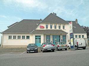 Bréauté-Beuzeville railway station | ||
| ||
 Bréauté Location within Normandy region  Bréauté | ||
| Coordinates: 49°37′46″N 0°24′01″E / 49.6294°N 0.4003°ECoordinates: 49°37′46″N 0°24′01″E / 49.6294°N 0.4003°E | ||
| Country | France | |
| Region | Normandy | |
| Department | Seine-Maritime | |
| Arrondissement | Le Havre | |
| Canton | Saint-Romain-de-Colbosc | |
| Intercommunality | CC Campagne de Caux | |
| Government | ||
| • Mayor (2008–2014) | Jacques Demare | |
| Area1 | 13.91 km2 (5.37 sq mi) | |
| Population (2006)2 | 1,210 | |
| • Density | 87/km2 (230/sq mi) | |
| Time zone | UTC+1 (CET) | |
| • Summer (DST) | UTC+2 (CEST) | |
| INSEE/Postal code | 76141 /76110 | |
| Elevation |
93–137 m (305–449 ft) (avg. 130 m or 430 ft) | |
|
1 French Land Register data, which excludes lakes, ponds, glaciers > 1 km2 (0.386 sq mi or 247 acres) and river estuaries. 2 Population without double counting: residents of multiple communes (e.g., students and military personnel) only counted once. | ||
Bréauté is a commune in the Seine-Maritime department in the Normandy region in northern France.
Geography
A farming village situated in the Pays de Caux, some 17 miles (27 km) northeast of Le Havre, at the junction of the D52 and D910 roads.
Heraldry
.svg.png) |
The arms of Bréauté are blazoned : Argent, a cinqfoil gules. |
Population
| Year | 1962 | 1968 | 1975 | 1982 | 1990 | 1999 | 2006 |
|---|---|---|---|---|---|---|---|
| Population | 928 | 978 | 990 | 1104 | 1052 | 1102 | 1210 |
| From the year 1962 on: No double counting—residents of multiple communes (e.g. students and military personnel) are counted only once. | |||||||
Places of interest
- The eighteenth century chateau d’Anteville.
- The church of St.Georges, with parts dating from the eleventh century.
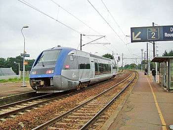
TER Class X locomotive at Bréauté station
See also
References
External links
| Wikimedia Commons has media related to Bréauté. |
- Bréauté on the Quid website (in French)
This article is issued from
Wikipedia.
The text is licensed under Creative Commons - Attribution - Sharealike.
Additional terms may apply for the media files.