Roncherolles-sur-le-Vivier
| Roncherolles-sur-le-Vivier | |
|---|---|
| Commune | |
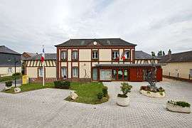 The town hall in Roncherolles-sur-le-Vivier | |
 Roncherolles-sur-le-Vivier Location within Normandy region  Roncherolles-sur-le-Vivier | |
| Coordinates: 49°28′01″N 1°11′02″E / 49.467°N 1.184°ECoordinates: 49°28′01″N 1°11′02″E / 49.467°N 1.184°E | |
| Country | France |
| Region | Normandy |
| Department | Seine-Maritime |
| Arrondissement | Rouen |
| Canton | Darnétal |
| Intercommunality | Métropole Rouen Normandie |
| Government | |
| • Mayor (2001 - 2008) | Bernard Jeanne |
| Area1 | 5.35 km2 (2.07 sq mi) |
| Population (2006)2 | 1,132 |
| • Density | 210/km2 (550/sq mi) |
| Time zone | UTC+1 (CET) |
| • Summer (DST) | UTC+2 (CEST) |
| INSEE/Postal code | 76536 /76160 |
| Elevation |
38–169 m (125–554 ft) (avg. 150 m or 490 ft) |
|
1 French Land Register data, which excludes lakes, ponds, glaciers > 1 km2 (0.386 sq mi or 247 acres) and river estuaries. 2 Population without double counting: residents of multiple communes (e.g., students and military personnel) only counted once. | |
Roncherolles-sur-le-Vivier is a commune in the Seine-Maritime department in the Normandy region in northern France.
Geography
A village of forestry and farming situated in the Pays de Bray, just 5 miles (8.0 km) northeast of Rouen at the junction of the D15 and the D91 roads.
Population
| 1962 | 1968 | 1975 | 1982 | 1990 | 1999 | 2006 |
|---|---|---|---|---|---|---|
| 387 | 378 | 505 | 845 | 1069 | 1091 | 1132 |
| Starting in 1962: Population without duplicates | ||||||
Places of interest
- The church of the Trinity, dating from the seventeenth century.
- The manorhouse de Bimare.
- The seventeenth-century château de Guillerville and its chapel.
See also
References
External links
| Wikimedia Commons has media related to Roncherolles-sur-le-Vivier. |
- Official website of Roncherolles-sur-le-Vivier (in French)
- Roncherolles-sur-le-Vivier on the Quid website (in French)
- Le Vivier de Roncherolles Website (in French)
This article is issued from
Wikipedia.
The text is licensed under Creative Commons - Attribution - Sharealike.
Additional terms may apply for the media files.