Sainte-Agathe-d'Aliermont
| Sainte-Agathe-d’Aliermont | |
|---|---|
| Commune | |
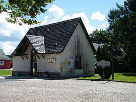 The town hall in Sainte-Agathe d'Aliermont | |
 Sainte-Agathe-d’Aliermont Location within Normandy region  Sainte-Agathe-d’Aliermont | |
| Coordinates: 49°49′39″N 1°19′53″E / 49.8275°N 1.3314°ECoordinates: 49°49′39″N 1°19′53″E / 49.8275°N 1.3314°E | |
| Country | France |
| Region | Normandy |
| Department | Seine-Maritime |
| Arrondissement | Dieppe |
| Canton | Neufchâtel-en-Bray |
| Intercommunality | CC Londinières |
| Government | |
| • Mayor (2008–2014) | Jean-Paul Gauzès |
| Area1 | 7.97 km2 (3.08 sq mi) |
| Population (2006)2 | 309 |
| • Density | 39/km2 (100/sq mi) |
| Time zone | UTC+1 (CET) |
| • Summer (DST) | UTC+2 (CEST) |
| INSEE/Postal code | 76553 /76660 |
| Elevation |
85–197 m (279–646 ft) (avg. 185 m or 607 ft) |
|
1 French Land Register data, which excludes lakes, ponds, glaciers > 1 km2 (0.386 sq mi or 247 acres) and river estuaries. 2 Population without double counting: residents of multiple communes (e.g., students and military personnel) only counted once. | |
Sainte-Agathe-d’Aliermont is a commune in the Seine-Maritime department in the Normandy region in northern France.
Geography
Sainte-Agathe-d’Aliermont is a farming village situated in the Pays de Bray, some 11 miles (18 km) southeast of Dieppe at the junction of the D56 and the D115 roads.
Population
| 1962 | 1968 | 1975 | 1982 | 1990 | 1999 | 2006 |
|---|---|---|---|---|---|---|
| 215 | 234 | 256 | 247 | 257 | 291 | 306 |
| Starting in 1962: Population without duplicates | ||||||
Places of interest
- The chapel of St. Charles at Beauval.
- The church of St. Agathe, dating from the thirteenth century.
See also
References
External links
| Wikimedia Commons has media related to Sainte-Agathe-d'Aliermont. |
- Sainte-Agathe-d’Aliermont on the Quid website (in French)
This article is issued from
Wikipedia.
The text is licensed under Creative Commons - Attribution - Sharealike.
Additional terms may apply for the media files.