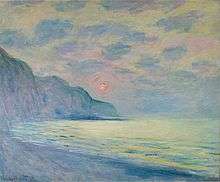
Hautot-sur-Mer
| Hautot-sur-Mer | ||
|---|---|---|
| Commune | ||
|
The church of Pourville | ||
| ||
 Hautot-sur-Mer Location within Normandy region  Hautot-sur-Mer | ||
| Coordinates: 49°53′51″N 1°02′05″E / 49.8975°N 1.0347°ECoordinates: 49°53′51″N 1°02′05″E / 49.8975°N 1.0347°E | ||
| Country | France | |
| Region | Normandy | |
| Department | Seine-Maritime | |
| Arrondissement | Dieppe | |
| Canton | Dieppe-1 | |
| Intercommunality | Communauté d'agglomération de la Région Dieppoise | |
| Government | ||
| • Mayor (2014-2020) | Jean-Jacques Brument | |
| Area1 | 9.46 km2 (3.65 sq mi) | |
| Population (2011)2 | 1,977 | |
| • Density | 210/km2 (540/sq mi) | |
| Time zone | UTC+1 (CET) | |
| • Summer (DST) | UTC+2 (CEST) | |
| INSEE/Postal code | 76349 /76550 | |
| Elevation |
0–103 m (0–338 ft) (avg. 90 m or 300 ft) | |
|
1 French Land Register data, which excludes lakes, ponds, glaciers > 1 km2 (0.386 sq mi or 247 acres) and river estuaries. 2 Population without double counting: residents of multiple communes (e.g., students and military personnel) only counted once. | ||
Hautot-sur-Mer is a commune in the Seine-Maritime department in the Normandy region in north-western France.
Geography
A small town of farming and light industry situated in the Pays de Caux, immediately to the west of Dieppe, at the junction of the D 75, D 56 and D 925 roads. The chalk cliffs and pebble beach of the commune look out over the English Channel. The river Scie flows through the commune and to the sea at the small tourist resort of Pourville.
History
The commune was formed in 1822 by the joining together of the communes of Hautot ("Hotot" in 1240), Petit-Appeville and Pourville, on the coast. It was here that a large force of Canadian soldiers came ashore during the ill-fated Dieppe Raid on 19 August 1942.
Heraldry
 |
The arms of Hautot-sur-Mer are blazoned : Vert, a chief argent, overall a lion Or. |
Population
| Historical population | ||
|---|---|---|
| Year | Pop. | ±% |
| 1793 | 520 | — |
| 1800 | 505 | −2.9% |
| 1806 | 460 | −8.9% |
| 1821 | 502 | +9.1% |
| 1831 | 829 | +65.1% |
| 1836 | 868 | +4.7% |
| 1841 | 925 | +6.6% |
| 1846 | 950 | +2.7% |
| 1851 | 930 | −2.1% |
| 1856 | 990 | +6.5% |
| 1861 | 1,068 | +7.9% |
| 1866 | 1,118 | +4.7% |
| 1872 | 1,194 | +6.8% |
| 1876 | 1,183 | −0.9% |
| 1881 | 1,310 | +10.7% |
| 1886 | 1,487 | +13.5% |
| 1891 | 1,384 | −6.9% |
| 1896 | 1,272 | −8.1% |
| 1901 | 1,342 | +5.5% |
| 1906 | 1,483 | +10.5% |
| 1911 | 1,431 | −3.5% |
| 1921 | 1,361 | −4.9% |
| 1926 | 1,311 | −3.7% |
| 1931 | 1,419 | +8.2% |
| 1936 | 1,589 | +12.0% |
| 1946 | 1,689 | +6.3% |
| 1954 | 1,903 | +12.7% |
| 1962 | 1,639 | −13.9% |
| 1968 | 1,657 | +1.1% |
| 1975 | 1,912 | +15.4% |
| 1982 | 1,982 | +3.7% |
| 1990 | 2,211 | +11.6% |
| 1999 | 2,120 | −4.1% |
| 2006 | 2,007 | −5.3% |
| 2007 | 1,991 | −0.8% |
| 2011 | 1,977 | −0.7% |
Places of interest

- A nineteenth century château.
- The ruins of a feudal castle.
- A memorial to the World War II raid.
- The two churches of St.Remi, both dating from the sixteenth century.
- The modern church at Petit-Appeville.
- Two 16th-century stone crosses.
See also
References
External links
| Wikimedia Commons has media related to Hautot-sur-Mer. |
- Gallery of photos of Pourville and Varengeville (in French)
- Hautot-sur-Mer on the Quid website (in French)