Wierre-Effroy
Wierre-Effroy is a commune in the Pas-de-Calais department in the Hauts-de-France region of France.
Wierre-Effroy | |
|---|---|
 The church of Wierre-Effroy | |
Location of Wierre-Effroy 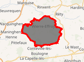
| |
 Wierre-Effroy  Wierre-Effroy | |
| Coordinates: 50°46′44″N 1°44′21″E | |
| Country | France |
| Region | Hauts-de-France |
| Department | Pas-de-Calais |
| Arrondissement | Boulogne-sur-Mer |
| Canton | Desvres |
| Intercommunality | Terre des Deux Caps |
| Government | |
| • Mayor (2014-2020) | Jean-Pierre Louvet |
| Area 1 | 18.91 km2 (7.30 sq mi) |
| Population (2017-01-01)[1] | 857 |
| • Density | 45/km2 (120/sq mi) |
| Time zone | UTC+01:00 (CET) |
| • Summer (DST) | UTC+02:00 (CEST) |
| INSEE/Postal code | 62889 /62720 |
| Elevation | 14–96 m (46–315 ft) (avg. 136 m or 446 ft) |
| 1 French Land Register data, which excludes lakes, ponds, glaciers > 1 km2 (0.386 sq mi or 247 acres) and river estuaries. | |
Geography
Wierre-Effroy is situated some 8 miles (13 km) northeast of Boulogne, at the junction of the D232 and D234 roads.
Population
| Historical population | ||
|---|---|---|
| Year | Pop. | ±% |
| 2006 | 777 | — |
| 2007 | 782 | +0.6% |
| 2008 | 803 | +2.7% |
| 2009 | 794 | −1.1% |
| 2010 | 788 | −0.8% |
| 2011 | 781 | −0.9% |
| 2012 | 775 | −0.8% |
| 2013 | 772 | −0.4% |
| 2014 | 773 | +0.1% |
| 2015 | 801 | +3.6% |
| 2016 | 829 | +3.5% |
Places of interest
- The church of St.Pierre, dating from the twelfth century.
- The church of St.Laurent at the hamlet of Hesdres, dating from the twelfth century.
- A sixteenth-century fortified manorhouse.
- A Battle of Britain pilot was shot down and crashed in a field near to the village. Time Team dug this site in 2000.
External links
| Wikimedia Commons has media related to Wierre-Effroy. |
- Wierre-Effroy on the Quid website (in French)
| Authority control |
|
|---|
This article is issued from Wikipedia. The text is licensed under Creative Commons - Attribution - Sharealike. Additional terms may apply for the media files.