Fresnes-lès-Montauban
Fresnes-lès-Montauban is a commune in the Pas-de-Calais department in the Hauts-de-France region of France.
Fresnes-lès-Montauban | |
|---|---|
 The town hall and church of Fresnes-lès-Montauban | |
 Coat of arms | |
Location of Fresnes-lès-Montauban 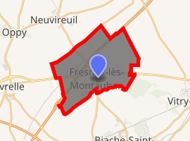
| |
 Fresnes-lès-Montauban  Fresnes-lès-Montauban | |
| Coordinates: 50°20′01″N 2°55′55″E | |
| Country | France |
| Region | Hauts-de-France |
| Department | Pas-de-Calais |
| Arrondissement | Arras |
| Canton | Brebières |
| Intercommunality | CC Osartis Marquion |
| Government | |
| • Mayor (2008–2014) | André Lacroix |
| Area 1 | 4.95 km2 (1.91 sq mi) |
| Population (2017-01-01)[1] | 572 |
| • Density | 120/km2 (300/sq mi) |
| Time zone | UTC+01:00 (CET) |
| • Summer (DST) | UTC+02:00 (CEST) |
| INSEE/Postal code | 62355 /62490 |
| Elevation | 41–63 m (135–207 ft) (avg. 45 m or 148 ft) |
| 1 French Land Register data, which excludes lakes, ponds, glaciers > 1 km2 (0.386 sq mi or 247 acres) and river estuaries. | |
Geography
A farming village situated 9 miles (14.5 km) northeast of Arras, at the junction of the N50 and the D46 roads. Junction 16 of the A1 autoroute is within a few yards of the commune.
Population
| Year | 1962 | 1968 | 1975 | 1982 | 1990 | 1999 |
|---|---|---|---|---|---|---|
| Population | 370 | 380 | 386 | 454 | 538 | 499 |
| From the year 1962 on: No double counting—residents of multiple communes (e.g. students and military personnel) are counted only once. | ||||||
Places of interest
- The church of Notre-Dame, rebuilt, as was much of the village, after World War I.
References
- "Populations légales 2017". INSEE. Retrieved 6 January 2020.
| Wikimedia Commons has media related to Fresnes-lès-Montauban. |
| Authority control |
|
|---|
This article is issued from Wikipedia. The text is licensed under Creative Commons - Attribution - Sharealike. Additional terms may apply for the media files.