Tubersent
Tubersent is a commune in the Pas-de-Calais department in the Hauts-de-France region of France.
Tubersent | |
|---|---|
 The church of Tubersent | |
Location of Tubersent 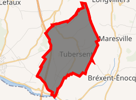
| |
 Tubersent  Tubersent | |
| Coordinates: 50°31′14″N 1°42′19″E | |
| Country | France |
| Region | Hauts-de-France |
| Department | Pas-de-Calais |
| Arrondissement | Montreuil |
| Canton | Étaples |
| Intercommunality | CA Deux Baies en Montreuillois |
| Government | |
| • Mayor | Jean Liebaert |
| Area 1 | 6.9 km2 (2.7 sq mi) |
| Population (2017-01-01)[1] | 538 |
| • Density | 78/km2 (200/sq mi) |
| Time zone | UTC+01:00 (CET) |
| • Summer (DST) | UTC+02:00 (CEST) |
| INSEE/Postal code | 62832 /62630 |
| Elevation | 2–105 m (6.6–344.5 ft) (avg. 14 m or 46 ft) |
| 1 French Land Register data, which excludes lakes, ponds, glaciers > 1 km2 (0.386 sq mi or 247 acres) and river estuaries. | |
History
First mentioned in the 9th century as "Thorbodessem" (or "Thornbodeshem" in 877), the place later (1097) was called "Turbodessem".
Places of interest
Geography
Tubersent is located 5 miles (8 km) northeast of Montreuil-sur-Mer on the D145 road.

Map of the commune and adjacent places
Population
| Year | 1962 | 1968 | 1975 | 1982 | 1990 | 1999 | 2006 |
|---|---|---|---|---|---|---|---|
| Population | 309 | 318 | 287 | 351 | 448 | 472 | 526 |
| From the year 1962 on: No double counting—residents of multiple communes (e.g. students and military personnel) are counted only once. | |||||||
References
- "Populations légales 2017". INSEE. Retrieved 6 January 2020.
| Wikimedia Commons has media related to Tubersent. |
| Authority control |
|
|---|
This article is issued from Wikipedia. The text is licensed under Creative Commons - Attribution - Sharealike. Additional terms may apply for the media files.