Marles-sur-Canche
Marles-sur-Canche is a commune in the Pas-de-Calais department in the Hauts-de-France region of France.
Marles-sur-Canche | |
|---|---|
 The church of Marles-sur-Canche | |
 Coat of arms | |
Location of Marles-sur-Canche 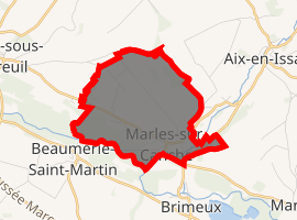
| |
 Marles-sur-Canche  Marles-sur-Canche | |
| Coordinates: 50°27′31″N 1°49′41″E | |
| Country | France |
| Region | Hauts-de-France |
| Department | Pas-de-Calais |
| Arrondissement | Montreuil |
| Canton | Auxi-le-Château |
| Intercommunality | CC Sept Vallées |
| Government | |
| • Mayor | Norbert Trupin |
| Area 1 | 5.1 km2 (2.0 sq mi) |
| Population (2017-01-01)[1] | 299 |
| • Density | 59/km2 (150/sq mi) |
| Time zone | UTC+01:00 (CET) |
| • Summer (DST) | UTC+02:00 (CEST) |
| INSEE/Postal code | 62556 /62170 |
| Elevation | 5–79 m (16–259 ft) (avg. 46 m or 151 ft) |
| 1 French Land Register data, which excludes lakes, ponds, glaciers > 1 km2 (0.386 sq mi or 247 acres) and river estuaries. | |
Geography
Marles-sur-Canche is situated in the valley of the Canche river, 2.3 miles (4 km) southeast of Montreuil-sur-Mer, on the D113 road.
Population
| 1962 | 1968 | 1975 | 1982 | 1990 | 1999 | 2006 |
|---|---|---|---|---|---|---|
| 263 | 268 | 259 | 274 | 293 | 294 | 301 |
| Census count starting from 1962: Population without duplicates | ||||||
Places of interest
- The seventeenth century church of St. Firmin.
References
- "Populations légales 2017". INSEE. Retrieved 6 January 2020.
| Wikimedia Commons has media related to Marles-sur-Canche. |
| Authority control |
|
|---|
This article is issued from Wikipedia. The text is licensed under Creative Commons - Attribution - Sharealike. Additional terms may apply for the media files.