Montigny-en-Gohelle
Montigny-en-Gohelle is a commune in the Pas-de-Calais department in the Hauts-de-France region of France.
Montigny-en-Gohelle | |
|---|---|
 The church of Montigny-en-Gohelle | |
 Coat of arms | |
Location of Montigny-en-Gohelle 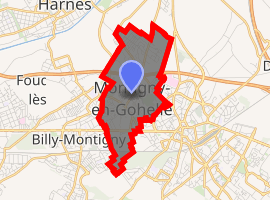
| |
 Montigny-en-Gohelle  Montigny-en-Gohelle | |
| Coordinates: 50°25′43″N 2°55′51″E | |
| Country | France |
| Region | Hauts-de-France |
| Department | Pas-de-Calais |
| Arrondissement | Lens |
| Canton | Hénin-Beaumont-1 |
| Intercommunality | Communauté d'agglomération d'Hénin-Carvin |
| Government | |
| • Mayor (2008–2014) | Jean-Claude Lecamus |
| Area 1 | 3.5 km2 (1.4 sq mi) |
| Population (2017-01-01)[1] | 10,198 |
| • Density | 2,900/km2 (7,500/sq mi) |
| Time zone | UTC+01:00 (CET) |
| • Summer (DST) | UTC+02:00 (CEST) |
| INSEE/Postal code | 62587 /62640 |
| Elevation | 23–42 m (75–138 ft) |
| 1 French Land Register data, which excludes lakes, ponds, glaciers > 1 km2 (0.386 sq mi or 247 acres) and river estuaries. | |
Geography
Montigny-en-Gohelle is former coalmining town, nowadays a light industrial and dormitory town, 7 miles (11 km) east of Lens, on the D46, D39e and the N43 roads. The A21 autoroute runs straight through the commune.
Population
| 1962 | 1968 | 1975 | 1982 | 1990 | 1999 | 2006 |
|---|---|---|---|---|---|---|
| 8787 | 8908 | 9232 | 11,140 | 10,629 | 10558 | 10,311 |
| Census count starting from 1962: Population without duplicates | ||||||
Places of interest
- The church of St.Madeleine, rebuilt along with most of the town, after the First World War.
External links
| Wikimedia Commons has media related to Montigny-en-Gohelle. |
| Authority control |
|
|---|
This article is issued from Wikipedia. The text is licensed under Creative Commons - Attribution - Sharealike. Additional terms may apply for the media files.