Hernicourt
Hernicourt is a commune in the Pas-de-Calais department in the Hauts-de-France region of France.
Hernicourt | |
|---|---|
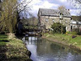 The Ternoise at Hernicourt | |
 Coat of arms | |
Location of Hernicourt 
| |
 Hernicourt  Hernicourt | |
| Coordinates: 50°24′21″N 2°18′27″E | |
| Country | France |
| Region | Hauts-de-France |
| Department | Pas-de-Calais |
| Arrondissement | Arras |
| Canton | Saint-Pol-sur-Ternoise |
| Intercommunality | CC Ternois |
| Government | |
| • Mayor (2008–2014) | Henri Boitel |
| Area 1 | 9.85 km2 (3.80 sq mi) |
| Population (2017-01-01)[1] | 567 |
| • Density | 58/km2 (150/sq mi) |
| Time zone | UTC+01:00 (CET) |
| • Summer (DST) | UTC+02:00 (CEST) |
| INSEE/Postal code | 62442 /62130 |
| Elevation | 65–149 m (213–489 ft) (avg. 73 m or 240 ft) |
| 1 French Land Register data, which excludes lakes, ponds, glaciers > 1 km2 (0.386 sq mi or 247 acres) and river estuaries. | |
Geography
A commune made up of three farming villages (Sautricourt, St.Martin and Hernicourt) that surround the neighbouring commune of Wavrans-sur-Ternoise. Situated 2.5 miles (4 km) north of St.Pol and 24 miles (39 km) northwest of Arras, on the D99 and the D343 roads.
Population
| Year | 1962 | 1968 | 1975 | 1982 | 1990 | 1999 | 2006 |
|---|---|---|---|---|---|---|---|
| Population | 369 | 373 | 378 | 395 | 416 | 423 | 446 |
| From the year 1962 on: No double counting—residents of multiple communes (e.g. students and military personnel) are counted only once. | |||||||
Places of interest
- The church of St.Vaast at Hernicourt, rebuilt in the 19th century.
- The medieval church of St.Martin.
- Evidence of an old castle at Sautricourt.
- A watermill.
References
- "Populations légales 2017". INSEE. Retrieved 6 January 2020.
| Wikimedia Commons has media related to Hernicourt. |
| Authority control |
|
|---|
This article is issued from Wikipedia. The text is licensed under Creative Commons - Attribution - Sharealike. Additional terms may apply for the media files.