Pont-à-Vendin
Pont-à-Vendin is a commune in the Pas-de-Calais department in the Hauts-de-France region of France.
Pont-à-Vendin | |
|---|---|
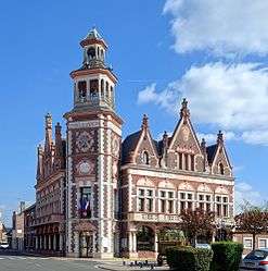 The town hall of Pont-à-Vendin | |
 Coat of arms | |
Location of Pont-à-Vendin 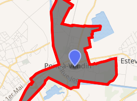
| |
 Pont-à-Vendin  Pont-à-Vendin | |
| Coordinates: 50°28′28″N 2°53′22″E | |
| Country | France |
| Region | Hauts-de-France |
| Department | Pas-de-Calais |
| Arrondissement | Lens |
| Canton | Wingles |
| Intercommunality | CA Lens-Liévin |
| Government | |
| • Mayor (2008–2014) | Bernard Ogier |
| Area 1 | 2.01 km2 (0.78 sq mi) |
| Population (2017-01-01)[1] | 3,187 |
| • Density | 1,600/km2 (4,100/sq mi) |
| Time zone | UTC+01:00 (CET) |
| • Summer (DST) | UTC+02:00 (CEST) |
| INSEE/Postal code | 62666 /62880 |
| Elevation | 21–41 m (69–135 ft) (avg. 26 m or 85 ft) |
| 1 French Land Register data, which excludes lakes, ponds, glaciers > 1 km2 (0.386 sq mi or 247 acres) and river estuaries. | |
Geography
Pont-à-Vendin is a farming and light industrial town, 5 miles (8.0 km) northeast of Lens, at the junction of the D30 and the D164 roads. The commune was important during the Middle Ages, as the Deûle river is bridged here.
Population
| 1962 | 1968 | 1975 | 1982 | 1990 | 1999 | 2006 |
|---|---|---|---|---|---|---|
| 3414 | 3489 | 3368 | 2882 | 2803 | 2899 | 3127 |
| Census count starting from 1962: Population without duplicates | ||||||
Places of interest
- The eighteenth century church of St. Vaast, rebuilt along with most of the town, after the First World War.
- The German war cemetery.
- The war memorial.
External links
| Wikimedia Commons has media related to Pont-à-Vendin. |
- War memorial website (in French)
- Website of the Communaupole de Lens-Liévin (in French)
| Authority control |
|
|---|
This article is issued from Wikipedia. The text is licensed under Creative Commons - Attribution - Sharealike. Additional terms may apply for the media files.