Achicourt
Achicourt is a commune in the Pas-de-Calais department in northern France.
Achicourt | |
|---|---|
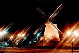 The windmill of Achicourt | |
.svg.png) Coat of arms | |
Location of Achicourt 
| |
 Achicourt  Achicourt | |
| Coordinates: 50°16′27″N 2°45′37″E | |
| Country | France |
| Region | Hauts-de-France |
| Department | Pas-de-Calais |
| Arrondissement | Arras |
| Canton | Arras-3 |
| Intercommunality | Arras |
| Government | |
| • Mayor (2014-2020) | Pascal Lachambre |
| Area 1 | 5.94 km2 (2.29 sq mi) |
| Population (2016) | 7,678 |
| • Density | 1,300/km2 (3,300/sq mi) |
| Time zone | UTC+01:00 (CET) |
| • Summer (DST) | UTC+02:00 (CEST) |
| INSEE/Postal code | 62004 /62217 |
| Elevation | 60–101 m (197–331 ft) (avg. 72 m or 236 ft) |
| 1 French Land Register data, which excludes lakes, ponds, glaciers > 1 km2 (0.386 sq mi or 247 acres) and river estuaries. | |
Geography
A light industrial suburb of Arras located 2 miles (3 km) southwest of Arras, at the D3 and D5 road junction. The river Crinchon flows through the town.
Population
| Historical population | ||
|---|---|---|
| Year | Pop. | ±% |
| 2004 | 7,675 | — |
| 2006 | 7,574 | −1.3% |
| 2007 | 7,625 | +0.7% |
| 2008 | 7,676 | +0.7% |
| 2009 | 7,727 | +0.7% |
| 2010 | 7,705 | −0.3% |
| 2011 | 8,045 | +4.4% |
| 2012 | 7,954 | −1.1% |
| 2013 | 7,852 | −1.3% |
| 2014 | 7,750 | −1.3% |
| 2015 | 7,694 | −0.7% |
| 2016 | 7,678 | −0.2% |
Sights
- The old windmill, rebuilt in 1994.
- The church of St.Vaast, dating from the twentieth century.
- The church of St.Christophe, dating from the twentieth century.
- Traces of a rectangular castle motte from the thirteenth century.
- The British war cemetery, where 131 English and Canadian soldiers are buried.
External links
| Wikimedia Commons has media related to Achicourt. |
| Authority control |
|
|---|
This article is issued from Wikipedia. The text is licensed under Creative Commons - Attribution - Sharealike. Additional terms may apply for the media files.