Maintenay
Maintenay is a commune in the Pas-de-Calais department in the Hauts-de-France region of France.
Maintenay | |
|---|---|
 Restored watermill | |
 Coat of arms | |
Location of Maintenay 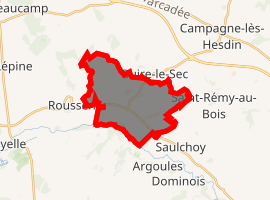
| |
 Maintenay  Maintenay | |
| Coordinates: 50°22′03″N 1°48′47″E | |
| Country | France |
| Region | Hauts-de-France |
| Department | Pas-de-Calais |
| Arrondissement | Montreuil |
| Canton | Auxi-le-Château |
| Intercommunality | CC Sept Vallées |
| Government | |
| • Mayor | Jean Seneschal |
| Area 1 | 12.11 km2 (4.68 sq mi) |
| Population (2017-01-01)[1] | 426 |
| • Density | 35/km2 (91/sq mi) |
| Time zone | UTC+01:00 (CET) |
| • Summer (DST) | UTC+02:00 (CEST) |
| INSEE/Postal code | 62538 /62870 |
| Elevation | 5–102 m (16–335 ft) (avg. 68 m or 223 ft) |
| 1 French Land Register data, which excludes lakes, ponds, glaciers > 1 km2 (0.386 sq mi or 247 acres) and river estuaries. | |
Geography
Maintenay is situated 9 miles (14 km) south of Montreuil-sur-Mer, at the junction of the D119 and D139 roads.
Population
| Year | 1962 | 1968 | 1975 | 1982 | 1990 | 1999 | 2006 |
|---|---|---|---|---|---|---|---|
| Population | 321 | 375 | 401 | 405 | 381 | 322 | 373 |
| From the year 1962 on: No double counting—residents of multiple communes (e.g. students and military personnel) are counted only once. | |||||||
Places of interest
- The Château de Bertronval.
- The thirteenth century church of Saint Nicholas.
- The watermill
References
- "Populations légales 2017". INSEE. Retrieved 6 January 2020.
| Wikimedia Commons has media related to Maintenay. |
| Authority control |
|
|---|
This article is issued from Wikipedia. The text is licensed under Creative Commons - Attribution - Sharealike. Additional terms may apply for the media files.