Éperlecques
Éperlecques (Dutch: Sperleke; Picard: Éparlecques) is a commune in the Pas-de-Calais department in the Hauts-de-France region of France.
Éperlecques | |
|---|---|
 St. Leodegar's Church | |
 Coat of arms | |
Location of Éperlecques 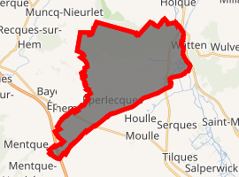
| |
 Éperlecques  Éperlecques | |
| Coordinates: 50°48′25″N 2°09′09″E | |
| Country | France |
| Region | Hauts-de-France |
| Department | Pas-de-Calais |
| Arrondissement | Saint-Omer |
| Canton | Saint-Omer |
| Intercommunality | Pays de Saint-Omer |
| Government | |
| • Mayor (2008–2014) | Michel Guilbert |
| Area 1 | 25.56 km2 (9.87 sq mi) |
| Population (2017-01-01)[1] | 3,640 |
| • Density | 140/km2 (370/sq mi) |
| Time zone | UTC+01:00 (CET) |
| • Summer (DST) | UTC+02:00 (CEST) |
| INSEE/Postal code | 62297 /62910 |
| Elevation | 0–97 m (0–318 ft) (avg. 15 m or 49 ft) |
| 1 French Land Register data, which excludes lakes, ponds, glaciers > 1 km2 (0.386 sq mi or 247 acres) and river estuaries. | |
Geography
It is a farming commune comprising eight hamlets, all found within the regional nature reserve of the Caps et Marais d'Opale, situated 6 miles (10 km) northwest of Saint-Omer, at the D222 and D219 road junction. The small river Liette runs through the village.
Population
| Year | 1962 | 1968 | 1975 | 1982 | 1990 | 1999 |
|---|---|---|---|---|---|---|
| Population | 2061 | 2168 | 2276 | 2556 | 2785 | 2885 |
| From the year 1962 on: No double counting—residents of multiple communes (e.g. students and military personnel) are counted only once. | ||||||
Places of interest
- The Blockhaus d'Éperlecques[2]
- St. Leodegar's church, dating from the sixteenth century.
- Seven chapels.
- Traces of ancient châteaux.
- The flour mill at Seigre.
Notes
- "Populations légales 2017". INSEE. Retrieved 6 January 2020.
- "Le Blockhaus d'Éperlecques". Retrieved 2007-05-25.
References
External links
| Wikimedia Commons has media related to Éperlecques. |
- Éperlecques on the Quid website (in French)

View towards Hellebrouck
This article is issued from Wikipedia. The text is licensed under Creative Commons - Attribution - Sharealike. Additional terms may apply for the media files.