Hénin-sur-Cojeul
Hénin-sur-Cojeul is a commune in the Pas-de-Calais department in the Hauts-de-France region of France.
Hénin-sur-Cojeul | |
|---|---|
 The RD 5 road in Hénin-sur-Cojeul | |
 Coat of arms | |
Location of Hénin-sur-Cojeul 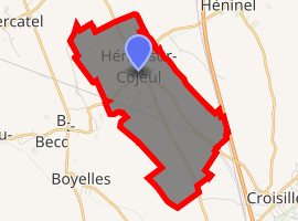
| |
 Hénin-sur-Cojeul  Hénin-sur-Cojeul | |
| Coordinates: 50°13′32″N 2°50′07″E | |
| Country | France |
| Region | Hauts-de-France |
| Department | Pas-de-Calais |
| Arrondissement | Arras |
| Canton | Arras-3 |
| Intercommunality | CU Arras |
| Government | |
| • Mayor (2017–Present) | Alfié Redman |
| Area 1 | 6.81 km2 (2.63 sq mi) |
| Population (2017-01-01)[1] | 527 |
| • Density | 77/km2 (200/sq mi) |
| Time zone | UTC+01:00 (CET) |
| • Summer (DST) | UTC+02:00 (CEST) |
| INSEE/Postal code | 62428 /62128 |
| Elevation | 63–106 m (207–348 ft) (avg. 65 m or 213 ft) |
| 1 French Land Register data, which excludes lakes, ponds, glaciers > 1 km2 (0.386 sq mi or 247 acres) and river estuaries. | |
Geography
A farming village situated 6 miles (10 km) southeast of Arras, at the junction of the D33 and the D5 roads.
Population
| Year | 1962 | 1968 | 1975 | 1982 | 1990 | 1999 | 2006 |
|---|---|---|---|---|---|---|---|
| Population | 310 | 344 | 324 | 367 | 365 | 372 | 434 |
| From the year 1962 on: No double counting—residents of multiple communes (e.g. students and military personnel) are counted only once. | |||||||
Places of interest
- The church of St.Vaast, rebuilt, as was most of the village, after the First World War.
- The Commonwealth War Graves Commission cemeteries.
External links
| Wikimedia Commons has media related to Hénin-sur-Cojeul. |
| Authority control |
|
|---|
This article is issued from Wikipedia. The text is licensed under Creative Commons - Attribution - Sharealike. Additional terms may apply for the media files.