Saint-Martin-Boulogne
Saint-Martin-Boulogne is a commune in the Pas-de-Calais department in the Hauts-de-France region of France.
Saint-Martin-Boulogne | |
|---|---|
 The church of Saint-Martin-Boulogne | |
 Coat of arms | |
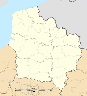
Location of Saint-Martin-Boulogne 
| |
 Saint-Martin-Boulogne  Saint-Martin-Boulogne | |
| Coordinates: 50°43′36″N 1°37′58″E | |
| Country | France |
| Region | Hauts-de-France |
| Department | Pas-de-Calais |
| Arrondissement | Boulogne-sur-Mer |
| Canton | Boulogne-sur-Mer-2 |
| Intercommunality | Communauté d'agglomération du Boulonnais |
| Government | |
| • Mayor (2010–2014) | Christian Bally |
| Area 1 | 13.15 km2 (5.08 sq mi) |
| Population (2017-01-01)[1] | 11,204 |
| • Density | 850/km2 (2,200/sq mi) |
| Time zone | UTC+01:00 (CET) |
| • Summer (DST) | UTC+02:00 (CEST) |
| INSEE/Postal code | 62758 /62280 |
| Elevation | 3–188 m (9.8–616.8 ft) (avg. 80 m or 260 ft) |
| 1 French Land Register data, which excludes lakes, ponds, glaciers > 1 km2 (0.386 sq mi or 247 acres) and river estuaries. | |
Geography
Saint-Martin-Boulogne is a farming and light industrial suburb east of Boulogne itself, at the junction of the N42 and D96 roads. Junctions 30 and 31 of the A16 autoroute lie within the commune's borders.
Population
| 1962 | 1968 | 1975 | 1982 | 1990 | 1999 | 2006 |
|---|---|---|---|---|---|---|
| 10,876 | 12,020 | 12,341 | 11,271 | 11,054 | 11,499 | 11,710 |
| Census count starting from 1962: Population without duplicates | ||||||
Places of interest
- The church of St.Martin, dating from the eighteenth century.
- The modern church of Sts.Bernadette and Yde.
- The Château de La Caucherie, dating from the nineteenth century.
- The Château du Denacre, dating from the eighteenth century.
- Three 17th century farmhouses and manorhouses.
- A fifteenth century windmill and the ruins of a watermill.
- The Meerut Military Cemetery (Commonwealth War Graves Commission cemetery).
External links
| Wikimedia Commons has media related to Saint-Martin-Boulogne. |
- Official town website (in French)
- The CWGC cemetery
- The Meerut Military Cemetery on the website "Remembrance Trails of the Great War in Northern France"
This article is issued from Wikipedia. The text is licensed under Creative Commons - Attribution - Sharealike. Additional terms may apply for the media files.