Bajus, Pas-de-Calais
Bajus is a commune in the Pas-de-Calais department in the Hauts-de-France region in northern France.
Bajus | |
|---|---|
 The church of Bajus | |
 Coat of arms | |
Location of Bajus 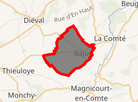
| |
 Bajus  Bajus | |
| Coordinates: 50°25′19″N 2°28′51″E | |
| Country | France |
| Region | Hauts-de-France |
| Department | Pas-de-Calais |
| Arrondissement | Béthune |
| Canton | Bruay-la-Buissière |
| Intercommunality | Communauté d'agglomération de Béthune-Bruay, Artois-Lys Romane |
| Government | |
| • Mayor (2014-2020) | Jean-Pierre Clément |
| Area 1 | 2.94 km2 (1.14 sq mi) |
| Population (2017-01-01)[1] | 365 |
| • Density | 120/km2 (320/sq mi) |
| Time zone | UTC+01:00 (CET) |
| • Summer (DST) | UTC+02:00 (CEST) |
| INSEE/Postal code | 62077 /62150 |
| Elevation | 87–158 m (285–518 ft) (avg. 100 m or 330 ft) |
| 1 French Land Register data, which excludes lakes, ponds, glaciers > 1 km2 (0.386 sq mi or 247 acres) and river estuaries. | |
Geography
A farming village located 20 miles (32 km) northwest of Arras at the junction of the D86E and D86E1 roads.
Population
| Historical population | ||
|---|---|---|
| Year | Pop. | ±% |
| 1962 | 191 | — |
| 1968 | 205 | +7.3% |
| 1975 | 202 | −1.5% |
| 1982 | 280 | +38.6% |
| 1990 | 290 | +3.6% |
| 1999 | 273 | −5.9% |
| 2006 | 293 | +7.3% |
| 2007 | 296 | +1.0% |
| 2009 | 303 | +2.4% |
| 2012 | 358 | +18.2% |
| 2015 | 371 | +3.6% |
Sights
References
- "Populations légales 2017". INSEE. Retrieved 6 January 2020.
| Wikimedia Commons has media related to Bajus. |
| Authority control |
|
|---|
This article is issued from Wikipedia. The text is licensed under Creative Commons - Attribution - Sharealike. Additional terms may apply for the media files.