Boubers-sur-Canche
Boubers-sur-Canche is a commune in the Pas-de-Calais department in the Hauts-de-France region in northern France.
Boubers-sur-Canche | |
|---|---|
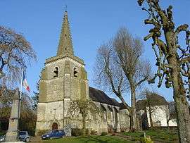 The church of Boubers-sur-Canche | |
 Coat of arms | |
Location of Boubers-sur-Canche 
| |
 Boubers-sur-Canche  Boubers-sur-Canche | |
| Coordinates: 50°17′28″N 2°14′16″E | |
| Country | France |
| Region | Hauts-de-France |
| Department | Pas-de-Calais |
| Arrondissement | Arras |
| Canton | Saint-Pol-sur-Ternoise |
| Intercommunality | CC Ternois |
| Government | |
| • Mayor (2008–2014) | Roger Dheilly |
| Area 1 | 9.23 km2 (3.56 sq mi) |
| Population (2017-01-01)[1] | 589 |
| • Density | 64/km2 (170/sq mi) |
| Time zone | UTC+01:00 (CET) |
| • Summer (DST) | UTC+02:00 (CEST) |
| INSEE/Postal code | 62158 /62270 |
| Elevation | 52–142 m (171–466 ft) (avg. 65 m or 213 ft) |
| 1 French Land Register data, which excludes lakes, ponds, glaciers > 1 km2 (0.386 sq mi or 247 acres) and river estuaries. | |
Geography
A farming village located 24 miles (38 km) west of Arras at the junction of the D112 and D340 roads, by the banks of the river Canche. The village wins national and international prizes for its flower display.
Population
| Historical population | ||
|---|---|---|
| Year | Pop. | ±% |
| 1962 | 530 | — |
| 1968 | 547 | +3.2% |
| 1975 | 618 | +13.0% |
| 1982 | 649 | +5.0% |
| 1990 | 604 | −6.9% |
| 1999 | 606 | +0.3% |
| 2009 | 600 | −1.0% |
Sights
- The church of St. Leger, dating from the seventeenth century.
- An eighteenth-century chateau.
- Public and private gardens.
External links
| Wikimedia Commons has media related to Boubers-sur-Canche. |
- Official website of the commune (in French)
- The Hennebellefamily’s gardens and nursery (in French)
- History and photos of the old distillery (in French)
- The camp site (in French)
| Authority control |
|
|---|
This article is issued from Wikipedia. The text is licensed under Creative Commons - Attribution - Sharealike. Additional terms may apply for the media files.