Couturelle
Couturelle is a commune in the Pas-de-Calais department in the Hauts-de-France region of France.
Couturelle | |
|---|---|
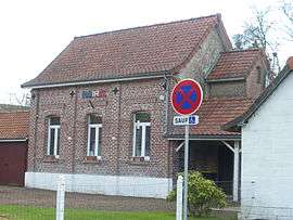 The town hall of Couturelle | |
 Coat of arms | |
Location of Couturelle 
| |
 Couturelle  Couturelle | |
| Coordinates: 50°12′33″N 2°30′03″E | |
| Country | France |
| Region | Hauts-de-France |
| Department | Pas-de-Calais |
| Arrondissement | Arras |
| Canton | Avesnes-le-Comte |
| Intercommunality | CC Campagnes de l'Artois |
| Government | |
| • Mayor (2008–2014) | René Tempez |
| Area 1 | 2.1 km2 (0.8 sq mi) |
| Population (2017-01-01)[1] | 65 |
| • Density | 31/km2 (80/sq mi) |
| Time zone | UTC+01:00 (CET) |
| • Summer (DST) | UTC+02:00 (CEST) |
| INSEE/Postal code | 62253 /62158 |
| Elevation | 130–171 m (427–561 ft) (avg. 159 m or 522 ft) |
| 1 French Land Register data, which excludes lakes, ponds, glaciers > 1 km2 (0.386 sq mi or 247 acres) and river estuaries. | |
Geography
A small farming village located 15 miles (25 km) southwest of Arras at the junction of the D25 and D23 roads, on the border with the department of the Somme.
Population
| Year | 1962 | 1968 | 1975 | 1982 | 1990 | 1999 |
|---|---|---|---|---|---|---|
| Population | 122 | 126 | 108 | 102 | 106 | 87 |
| From the year 1962 on: No double counting—residents of multiple communes (e.g. students and military personnel) are counted only once. | ||||||
Places of interest
- The church of St.Thomas, dating from the nineteenth century.
- The Commonwealth War Graves Commission cemetery.
- Remains of a 13th-century castle.
- The eighteenth-century chateau.
External links
| Wikimedia Commons has media related to Couturelle. |
| Authority control |
|
|---|
This article is issued from Wikipedia. The text is licensed under Creative Commons - Attribution - Sharealike. Additional terms may apply for the media files.