Hames-Boucres
Hames-Boucres is a commune in the Pas-de-Calais department in the Hauts-de-France region of France.
Hames-Boucres | |
|---|---|
_mairie.JPG) The town hall of Hames-Boucres | |
 Coat of arms | |
Location of Hames-Boucres 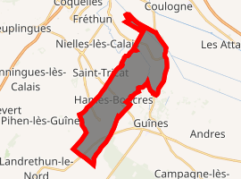
| |
 Hames-Boucres  Hames-Boucres | |
| Coordinates: 50°52′56″N 1°50′37″E | |
| Country | France |
| Region | Hauts-de-France |
| Department | Pas-de-Calais |
| Arrondissement | Calais |
| Canton | Calais-1 |
| Intercommunality | CA Grand Calais Terres et Mers |
| Government | |
| • Mayor (2008–2014) | René Lotte |
| Area 1 | 12.82 km2 (4.95 sq mi) |
| Population (2017-01-01)[1] | 1,469 |
| • Density | 110/km2 (300/sq mi) |
| Time zone | UTC+01:00 (CET) |
| • Summer (DST) | UTC+02:00 (CEST) |
| INSEE/Postal code | 62408 /62340 |
| Elevation | 0–86 m (0–282 ft) (avg. 5 m or 16 ft) |
| 1 French Land Register data, which excludes lakes, ponds, glaciers > 1 km2 (0.386 sq mi or 247 acres) and river estuaries. | |
Geography
A village located 6 miles (9 km) southwest of Calais, at the junction of the D215 and D231E2.
History
The commune was created from the two former parishes of Hames and Boucres in 1819. The two parish churches were located almost opposite each other and separated only by a street. The church of Hames was demolished during the Revolution. The English seized the castle in the 14th century, but it was retaken by Francis, Duke of Guise, who successfully claimed all of the Calais Pale for France in 1558.
Population
| Year | 1962 | 1968 | 1975 | 1982 | 1990 | 1999 |
|---|---|---|---|---|---|---|
| Population | 796 | 851 | 964 | 1047 | 1017 | 1106 |
| From the year 1962 on: No double counting—residents of multiple communes (e.g. students and military personnel) are counted only once. | ||||||
Places of interest
References
- "Populations légales 2017". INSEE. Retrieved 6 January 2020.
| Wikimedia Commons has media related to Hames-Boucres. |
| Authority control |
|
|---|
This article is issued from Wikipedia. The text is licensed under Creative Commons - Attribution - Sharealike. Additional terms may apply for the media files.