Givenchy-en-Gohelle
Givenchy-en-Gohelle (French pronunciation: [ʒivɑ̃ʃi ɑ̃ goɛl]) is a commune in the Pas-de-Calais department in the Hauts-de-France region of France. It is located 1.8 kilometres (1.1 mi) north of the Canadian National Vimy Memorial dedicated to the Battle of Vimy Ridge and the missing First World War Canadian soldiers with no known grave; the Memorial is also the site of two Canadian cemeteries.[2] The village was destroyed during World War I but was rebuilt after the war.[3]
Givenchy-en-Gohelle | |
|---|---|
 17th century Église Saint-Martin | |
.svg.png) Coat of arms | |
Location of Givenchy-en-Gohelle 
| |
 Givenchy-en-Gohelle  Givenchy-en-Gohelle | |
| Coordinates: 50°23′37″N 2°46′23″E | |
| Country | France |
| Region | Hauts-de-France |
| Department | Pas-de-Calais |
| Arrondissement | Lens |
| Canton | Liévin |
| Intercommunality | CA Lens-Liévin |
| Government | |
| • Mayor (2008–2014) | Robert Mieloch |
| Area 1 | 5.95 km2 (2.30 sq mi) |
| Population (2017-01-01)[1] | 1,947 |
| • Density | 330/km2 (850/sq mi) |
| Time zone | UTC+01:00 (CET) |
| • Summer (DST) | UTC+02:00 (CEST) |
| INSEE/Postal code | 62371 /62580 |
| Elevation | 48–148 m (157–486 ft) (avg. 97 m or 318 ft) |
| 1 French Land Register data, which excludes lakes, ponds, glaciers > 1 km2 (0.386 sq mi or 247 acres) and river estuaries. | |
Geography
Givenchy-en-Gohelle is a large farming village situated 6 miles (9.7 km) north of Arras, at the junction of the D51 and the D55 roads. Its neighboring communes are Souchez to the west, Angres to the northwest, Liévin to the north, Avion to the east and Vimy to the southeast.
The Bois de Givenchy or Givenchy Forest, covers much of the commune on its northern side. To further the agricultural range of products, the commune of Givenchy-en-Gohelle have planted grapes (chardonnay and pinot gris). The first grape harvest took place in 2000.
First World War
During the First World War, Givenchy-en-Gohelle was on the front line between German and Allied forces during the battles of Arras and was severely damaged, particularly during the Battle of Vimy Ridge in 1917. For much of the First World War, the village also was the site of sustained underground fighting between German and British tunneling units. Givenchy-en-Gohelle was taken by the 2nd Canadian Division on 13 April 1917. Over 150 war casualties (1914-1918) are commemorated at the Canadian cemetery here and 109 from the Battle of Vimy Ridge are buried here.[4]
The centennial commemoration of the Battle of Vimy Ridge was held at the Canadian National Vimy Memorial near the village on 9 April 2017.[5] Estimates before the event indicated that up to 30,000 would attend.[6]
By early April 2017, the village had been decorated with 500 Canadian flags.[3][7][3]
Population
| Year | 1962 | 1968 | 1975 | 1982 | 1990 | 1999 |
|---|---|---|---|---|---|---|
| Population | 1508 | 1555 | 1627 | 1755 | 1973 | 2051 |
| From the year 1962 on: No double counting—residents of multiple communes (e.g. students and military personnel) are counted only once. | ||||||
Places of interest
- The Canadian National Vimy Memorial to commemorate First World War Canadian dead and missing, presumed dead, in France.[2]
- The church of St. Martin, dating from the seventeenth century.
- The Commonwealth War Graves Commission Canadian memorial and cemeteries.
References
- "Populations légales 2017". INSEE. Retrieved 6 January 2020.
- "Canadian National Vimy Memorial, France". The Great War UK. The Great War UK. 2015. Retrieved 31 March 2017.
The ridge runs in a direction from Givenchy-en-Gohelle in the north-west to Farbus in the south-east.
- "French village decked out in Canadiana to mark Vimy Ridge centennial". 5 April 2017.
- Canada, Veterans Affairs. "Givenchy-en-Gohelle Canadian Cemetery - Memorials In France - First World War Memorials Overseas - Memorials Overseas - Memorials - Remembrance - Veterans Affairs Canada".
- "Vimy Ridge: Royals commemorate defining WW1 battle". BBC. 9 April 2017. Retrieved 9 April 2017.
- Siekierska, Alicja (31 March 2017), Toronto photographer to open exhibition to commemorate battle of Vimy Ridge, Toronto Star, retrieved 1 April 2017
- "French town plastered with over 500 Canadian flags for Vimy Ridge anniversary".
External links
| Wikimedia Commons has media related to Givenchy-en-Gohelle. |
Gallery
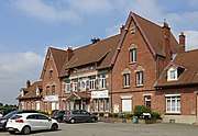 Town hall
 Saint-Martin church
 War memorial
| Authority control |
|
|---|