Fortel-en-Artois
Fortel-en-Artois is a commune in the Pas-de-Calais department in the Hauts-de-France region of France.
Fortel-en-Artois | |
|---|---|
 The centre of Fortel-en-Artois | |
 Coat of arms | |
Location of Fortel-en-Artois 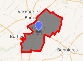
| |
 Fortel-en-Artois  Fortel-en-Artois | |
| Coordinates: 50°15′29″N 2°13′29″E | |
| Country | France |
| Region | Hauts-de-France |
| Department | Pas-de-Calais |
| Arrondissement | Arras |
| Canton | Saint-Pol-sur-Ternoise |
| Intercommunality | CC Ternois |
| Government | |
| • Mayor (2008–2014) | Daniel Nivel |
| Area 1 | 5.89 km2 (2.27 sq mi) |
| Population (2017-01-01)[1] | 211 |
| • Density | 36/km2 (93/sq mi) |
| Time zone | UTC+01:00 (CET) |
| • Summer (DST) | UTC+02:00 (CEST) |
| INSEE/Postal code | 62346 /62270 |
| Elevation | 83–144 m (272–472 ft) (avg. 122 m or 400 ft) |
| 1 French Land Register data, which excludes lakes, ponds, glaciers > 1 km2 (0.386 sq mi or 247 acres) and river estuaries. | |
Geography
A small farming village situated 25 miles (40.2 km) west of Arras, at the junction of the D115 and the D115E roads.
Population
| Year | 1962 | 1968 | 1975 | 1982 | 1990 | 1999 |
|---|---|---|---|---|---|---|
| Population | 166 | 187 | 160 | 186 | 181 | 155 |
| From the year 1962 on: No double counting—residents of multiple communes (e.g. students and military personnel) are counted only once. | ||||||
Places of interest
- The church of St.Pierre, dating from the eighteenth century.
- A big sandstone crucifix at the road junction.
References
- "Populations légales 2017". INSEE. Retrieved 6 January 2020.
| Wikimedia Commons has media related to Fortel-en-Artois. |
| Authority control |
|
|---|
This article is issued from Wikipedia. The text is licensed under Creative Commons - Attribution - Sharealike. Additional terms may apply for the media files.