Ruminghem
Ruminghem is a commune in the Pas-de-Calais department in the Hauts-de-France region of France.
Ruminghem | |
|---|---|
_mairie.JPG) The town hall of Ruminghem | |
 Coat of arms | |
Location of Ruminghem 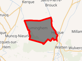
| |
 Ruminghem  Ruminghem | |
| Coordinates: 50°51′37″N 2°09′31″E | |
| Country | France |
| Region | Hauts-de-France |
| Department | Pas-de-Calais |
| Arrondissement | Calais |
| Canton | Marck |
| Intercommunality | Communauté de communes de la Région d'Audruicq |
| Government | |
| • Mayor | Yves Bacquet |
| Area 1 | 13.89 km2 (5.36 sq mi) |
| Population (2017-01-01)[1] | 1,650 |
| • Density | 120/km2 (310/sq mi) |
| Time zone | UTC+01:00 (CET) |
| • Summer (DST) | UTC+02:00 (CEST) |
| INSEE/Postal code | 62730 /62370 |
| Elevation | 1–64 m (3.3–210.0 ft) (avg. 3 m or 9.8 ft) |
| 1 French Land Register data, which excludes lakes, ponds, glaciers > 1 km2 (0.386 sq mi or 247 acres) and river estuaries. | |
Geography
Ruminghem is located about 10 miles (16 km) north of Saint-Omer on the D217 road.
Population
| 1962 | 1968 | 1975 | 1982 | 1990 | 1999 | 2006 |
|---|---|---|---|---|---|---|
| 924 | 968 | 927 | 1019 | 1120 | 1163 | 1449 |
| Census count starting from 1962: Population without duplicates | ||||||
Places of interest
- The church of St.Martin, dating from the 18th century.
References
- "Populations légales 2017". INSEE. Retrieved 6 January 2020.
External links
| Wikimedia Commons has media related to Ruminghem. |
- Ruminghem Carnival Association (in French)
- Ruminghem on the Quid website (in French)
| Authority control |
|
|---|
This article is issued from Wikipedia. The text is licensed under Creative Commons - Attribution - Sharealike. Additional terms may apply for the media files.