Clairmarais
Clairmarais is a commune in the Pas-de-Calais department in the Hauts-de-France region of France.
Clairmarais | |
|---|---|
 Romelaëre nature reserve | |
 Coat of arms | |
Location of Clairmarais 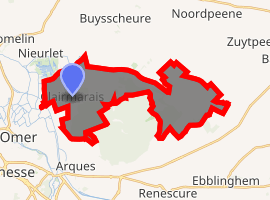
| |
 Clairmarais  Clairmarais | |
| Coordinates: 50°46′27″N 2°18′03″E | |
| Country | France |
| Region | Hauts-de-France |
| Department | Pas-de-Calais |
| Arrondissement | Saint-Omer |
| Canton | Saint-Omer |
| Intercommunality | Pays de Saint-Omer |
| Government | |
| • Mayor (2001–2008) | Nicole Heneman |
| Area 1 | 18.02 km2 (6.96 sq mi) |
| Population (2017-01-01)[1] | 624 |
| • Density | 35/km2 (90/sq mi) |
| Time zone | UTC+01:00 (CET) |
| • Summer (DST) | UTC+02:00 (CEST) |
| INSEE/Postal code | 62225 /62500 |
| Elevation | 1–34 m (3.3–111.5 ft) (avg. 9 m or 30 ft) |
| 1 French Land Register data, which excludes lakes, ponds, glaciers > 1 km2 (0.386 sq mi or 247 acres) and river estuaries. | |
Geography
A farming village situated in reclaimed marshland, 2 miles (3 km) northeast of Saint-Omer, on the D209 road. The Neufosse Canal, which connects the Aa and Lys Rivers, passes by the commune.
Population
| Year | 1962 | 1968 | 1975 | 1982 | 1990 | 1999 |
|---|---|---|---|---|---|---|
| Population | 397 | 410 | 480 | 598 | 687 | 689 |
| From the year 1962 on: No double counting—residents of multiple communes (e.g. students and military personnel) are counted only once. | ||||||
History

It owes its origin to the famous Cistercian abbey founded by St. Bernard in 1140.
He gave the village the name of Claromarisco (later to be Clarus Mariscus and then Clermarez) because of the huge marshes and many rivers in the vicinity. The Dutch Klaarmares and West Flemish Cleremeersch names reflect the nature of the terrain, too.
Clairmarais became a fully-fledged common in 1790 when the abbey was going to be destroyed and sold as a national asset during the French Revolution.
During World War I, the Royal Flying Corps, and later Royal Air Force, operated from Clairmarais aerodrome.[2]
Places of interest
- The church of St. Bernard, dating from the nineteenth century.
- A windmill.
- Vestiges of the 13th century abbey including the remains of the entrance to the abbey with gatehouse buildings, a chapel and dovecote.
- The eighteenth century Cistercian farm of Cloquette.
- The cave of Notre-Dame de Lourdes which is host to a pilgrimage on August 15. It is the largest in France, north of the Seine.
- The National nature reserve of Romelaëre.[3]
References
- "Populations légales 2017". INSEE. Retrieved 6 January 2020.
- O'Connor, Mike. Airfields and Airmen: The Channel Coast. pp. 171–173. ISBN 9781844152582.
- JO; Decree No. 2008-220 of 5 March 2008 covering creation of the national nature reserve "Romelaëre Lakes" Nord and Pas-de-Calais
External links
| Wikimedia Commons has media related to Clairmarais. |
- A Clairmarais website (in French)
- Another Clairmarais website (in French)
- Clairmarais on the Quid website (in French)
| Authority control |
|
|---|