Leulinghen-Bernes
Leulinghen-Bernes is a commune in the Pas-de-Calais department in the Hauts-de-France region of France.
Leulinghen-Bernes | |
|---|---|
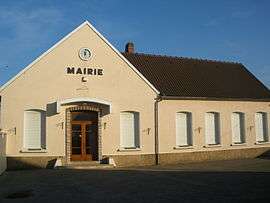 The town hall of Leulinghen-Bernes | |
 Coat of arms | |
Location of Leulinghen-Bernes 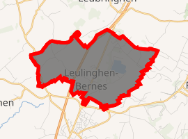
| |
 Leulinghen-Bernes  Leulinghen-Bernes | |
| Coordinates: 50°49′51″N 1°43′09″E | |
| Country | France |
| Region | Hauts-de-France |
| Department | Pas-de-Calais |
| Arrondissement | Boulogne-sur-Mer |
| Canton | Desvres |
| Intercommunality | Communauté de communes de la Terre des Deux Caps |
| Government | |
| • Mayor (2008–2014) | Jacques Fasquel |
| Area 1 | 6.9 km2 (2.7 sq mi) |
| Population (2017-01-01)[1] | 470 |
| • Density | 68/km2 (180/sq mi) |
| Time zone | UTC+01:00 (CET) |
| • Summer (DST) | UTC+02:00 (CEST) |
| INSEE/Postal code | 62505 /62250 |
| Elevation | 8–100 m (26–328 ft) (avg. 80 m or 260 ft) |
| 1 French Land Register data, which excludes lakes, ponds, glaciers > 1 km2 (0.386 sq mi or 247 acres) and river estuaries. | |
Geography
Leulinghen-Bernes is situated some 10 miles (16 km) northeast of Boulogne, at the junction of the D191 and D231 roads. The A16 autoroute cuts through the middle of the commune's territory.
Population
| 1962 | 1968 | 1975 | 1982 | 1990 | 1999 | 2006 |
|---|---|---|---|---|---|---|
| 243 | 250 | 266 | 266 | 401 | 398 | 417 |
| Census count starting from 1962: Population without duplicates | ||||||
Places of interest
- The church of St.Leger, dating from the fourteenth century.
References
- "Populations légales 2017". INSEE. Retrieved 6 January 2020.
| Wikimedia Commons has media related to Leulinghen-Bernes. |
| Authority control |
|
|---|
This article is issued from Wikipedia. The text is licensed under Creative Commons - Attribution - Sharealike. Additional terms may apply for the media files.