Magnicourt-en-Comte
Magnicourt-en-Comte is a commune in the Pas-de-Calais department in the Hauts-de-France region of France.
Magnicourt-en-Comte | |
|---|---|
 The church of Magnicourt-en-Comte | |
 Coat of arms | |
Location of Magnicourt-en-Comte 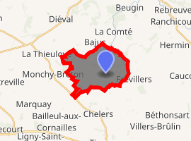
| |
 Magnicourt-en-Comte  Magnicourt-en-Comte | |
| Coordinates: 50°24′06″N 2°29′32″E | |
| Country | France |
| Region | Hauts-de-France |
| Department | Pas-de-Calais |
| Arrondissement | Arras |
| Canton | Avesnes-le-Comte |
| Intercommunality | CC Campagnes de l'Artois |
| Government | |
| • Mayor (2008–2014) | Pierre Guillemant |
| Area 1 | 9.86 km2 (3.81 sq mi) |
| Population (2017-01-01)[1] | 649 |
| • Density | 66/km2 (170/sq mi) |
| Time zone | UTC+01:00 (CET) |
| • Summer (DST) | UTC+02:00 (CEST) |
| INSEE/Postal code | 62536 /62127 |
| Elevation | 86–181 m (282–594 ft) (avg. 98 m or 322 ft) |
| 1 French Land Register data, which excludes lakes, ponds, glaciers > 1 km2 (0.386 sq mi or 247 acres) and river estuaries. | |
Geography
Magnicourt-en-Comte is situated 17 miles (27 km) northwest of Arras, at the junction of the D83, D86 and the D74 roads.
Population
| Year | 1962 | 1968 | 1975 | 1982 | 1990 | 1999 | 2006 |
|---|---|---|---|---|---|---|---|
| Population | 541 | 576 | 567 | 608 | 606 | 553 | 611 |
| From the year 1962 on: No double counting—residents of multiple communes (e.g. students and military personnel) are counted only once. | |||||||
Places of interest
- The church of St.Leger, dating from the twelfth century.
- The remains of an old chateau, destroyed in 1639.
- Watermills
References
- "Populations légales 2017". INSEE. Retrieved 6 January 2020.
| Wikimedia Commons has media related to Magnicourt-en-Comte. |
| Authority control |
|
|---|
This article is issued from Wikipedia. The text is licensed under Creative Commons - Attribution - Sharealike. Additional terms may apply for the media files.