La Herlière
La Herlière is a commune in the Pas-de-Calais department in the Hauts-de-France region of France.
La Herlière | |
|---|---|
 The church of La Herlière | |
 Coat of arms | |
Location of La Herlière 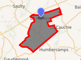
| |
 La Herlière  La Herlière | |
| Coordinates: 50°12′32″N 2°33′36″E | |
| Country | France |
| Region | Hauts-de-France |
| Department | Pas-de-Calais |
| Arrondissement | Arras |
| Canton | Avesnes-le-Comte |
| Intercommunality | CC Campagnes de l'Artois |
| Government | |
| • Mayor (2008–2014) | Alain Traisnel |
| Area 1 | 5.4 km2 (2.1 sq mi) |
| Population (2017-01-01)[1] | 149 |
| • Density | 28/km2 (71/sq mi) |
| Time zone | UTC+01:00 (CET) |
| • Summer (DST) | UTC+02:00 (CEST) |
| INSEE/Postal code | 62434 /62158 |
| Elevation | 142–178 m (466–584 ft) (avg. 171 m or 561 ft) |
| 1 French Land Register data, which excludes lakes, ponds, glaciers > 1 km2 (0.386 sq mi or 247 acres) and river estuaries. | |
Geography
A small farming village situated 13 miles (21 km) southwest of Arras, at the junction of the D26 and the N25 road.
Population
| Year | 1962 | 1968 | 1975 | 1982 | 1990 | 1999 | 2006 |
|---|---|---|---|---|---|---|---|
| Population | 107 | 137 | 121 | 124 | 135 | 127 | 158 |
| From the year 1962 on: No double counting—residents of multiple communes (e.g. students and military personnel) are counted only once. | |||||||
Places of interest
- The church of St.Jean, dating from the twentieth century.
References
- "Populations légales 2017". INSEE. Retrieved 6 January 2020.
| Wikimedia Commons has media related to La Herlière. |
This article is issued from Wikipedia. The text is licensed under Creative Commons - Attribution - Sharealike. Additional terms may apply for the media files.