Hesdigneul-lès-Boulogne
Hesdigneul-lès-Boulogne is a commune in the Pas-de-Calais department in the Hauts-de-France region of France.
Hesdigneul-lès-Boulogne | |
|---|---|
 The town hall of Hesdigneul-lès-Boulogne | |
 Coat of arms | |
Location of Hesdigneul-lès-Boulogne 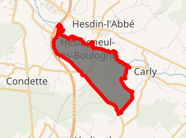
| |
 Hesdigneul-lès-Boulogne  Hesdigneul-lès-Boulogne | |
| Coordinates: 50°39′36″N 1°40′13″E | |
| Country | France |
| Region | Hauts-de-France |
| Department | Pas-de-Calais |
| Arrondissement | Boulogne-sur-Mer |
| Canton | Outreau |
| Intercommunality | Communauté d'agglomération du Boulonnais |
| Government | |
| • Mayor (2008–2014) | André Bodart |
| Area 1 | 3.32 km2 (1.28 sq mi) |
| Population (2017-01-01)[1] | 677 |
| • Density | 200/km2 (530/sq mi) |
| Time zone | UTC+01:00 (CET) |
| • Summer (DST) | UTC+02:00 (CEST) |
| INSEE/Postal code | 62446 /62360 |
| Elevation | 8–67 m (26–220 ft) (avg. 14 m or 46 ft) |
| 1 French Land Register data, which excludes lakes, ponds, glaciers > 1 km2 (0.386 sq mi or 247 acres) and river estuaries. | |
Geography
A forestry and farming village situated some 5 miles (8.0 km) south of Boulogne, at the junction of the D52 and D240 roads. The A16 autoroute forms the western border of the commune and the river Liane the north and eastern.
Population
| Year | 1962 | 1968 | 1975 | 1982 | 1990 | 1999 | 2006 |
|---|---|---|---|---|---|---|---|
| Population | 581 | 620 | 621 | 621 | 618 | 579 | 724 |
| From the year 1962 on: No double counting—residents of multiple communes (e.g. students and military personnel) are counted only once. | |||||||
Places of interest
- The church of St. Eloi, dating from the nineteenth century.
References
- "Populations légales 2017". INSEE. Retrieved 6 January 2020.
| Wikimedia Commons has media related to Hesdigneul-lès-Boulogne. |
| Authority control |
|
|---|
This article is issued from Wikipedia. The text is licensed under Creative Commons - Attribution - Sharealike. Additional terms may apply for the media files.