Maninghen-Henne
Maninghen-Henne is a commune in the Pas-de-Calais department in the Hauts-de-France region of France.
Maninghen-Henne | |
|---|---|
 The church of Maninghen-Henne | |
 Coat of arms | |
Location of Maninghen-Henne 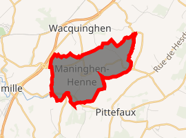
| |
 Maninghen-Henne  Maninghen-Henne | |
| Coordinates: 50°46′08″N 1°40′10″E | |
| Country | France |
| Region | Hauts-de-France |
| Department | Pas-de-Calais |
| Arrondissement | Boulogne-sur-Mer |
| Canton | Desvres |
| Intercommunality | Communauté de communes de la Terre des Deux Caps |
| Government | |
| • Mayor (2008–2014) | Michel Lagaise |
| Area 1 | 3.99 km2 (1.54 sq mi) |
| Population (2017-01-01)[1] | 314 |
| • Density | 79/km2 (200/sq mi) |
| Time zone | UTC+01:00 (CET) |
| • Summer (DST) | UTC+02:00 (CEST) |
| INSEE/Postal code | 62546 /62250 |
| Elevation | 9–115 m (30–377 ft) (avg. 89 m or 292 ft) |
| 1 French Land Register data, which excludes lakes, ponds, glaciers > 1 km2 (0.386 sq mi or 247 acres) and river estuaries. | |
Geography
Maninghen-Henne is situated some 5 miles (8.0 km) northeast of Boulogne, at the junction of the D242 and D233 roads.
Population
| Year | 1962 | 1968 | 1975 | 1982 | 1990 | 1999 | 2006 |
|---|---|---|---|---|---|---|---|
| Population | 116 | 123 | 112 | 181 | 211 | 298 | 318 |
| From the year 1962 on: No double counting—residents of multiple communes (e.g. students and military personnel) are counted only once. | |||||||
Places of interest
- The church of St.Martin, dating from the nineteenth century.
- A windmill.
- Two 17th century farmhouses.
References
- "Populations légales 2017". INSEE. Retrieved 6 January 2020.
| Wikimedia Commons has media related to Maninghen-Henne. |
| Authority control |
|
|---|
This article is issued from Wikipedia. The text is licensed under Creative Commons - Attribution - Sharealike. Additional terms may apply for the media files.