Lambres
Lambres is a commune in the Pas-de-Calais department in the Hauts-de-France region of France.
Lambres | |
|---|---|
_mairie.JPG) The town hall of Lambres | |
 Coat of arms | |
Location of Lambres 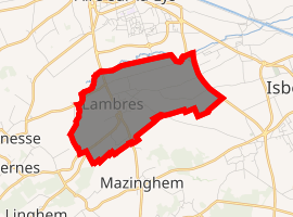
| |
 Lambres  Lambres | |
| Coordinates: 50°37′03″N 2°23′51″E | |
| Country | France |
| Region | Hauts-de-France |
| Department | Pas-de-Calais |
| Arrondissement | Béthune |
| Canton | Aire-sur-la-Lys |
| Intercommunality | CA Béthune-Bruay, Artois-Lys Romane |
| Government | |
| • Mayor (2008–2014) | Serge Tirloir |
| Area 1 | 4.37 km2 (1.69 sq mi) |
| Population (2017-01-01)[1] | 1,061 |
| • Density | 240/km2 (630/sq mi) |
| Time zone | UTC+01:00 (CET) |
| • Summer (DST) | UTC+02:00 (CEST) |
| INSEE/Postal code | 62486 /62120 |
| Elevation | 18–49 m (59–161 ft) (avg. 25 m or 82 ft) |
| 1 French Land Register data, which excludes lakes, ponds, glaciers > 1 km2 (0.386 sq mi or 247 acres) and river estuaries. | |
Geography
A farming village, situated some 10 miles (16.1 km) northwest of Béthune and 30 miles (48.3 km) west of Lille at the junction of the D90 and the N43.
Population
| Year | 1962 | 1968 | 1975 | 1982 | 1990 | 1999 | 2006 |
|---|---|---|---|---|---|---|---|
| Population | 816 | 884 | 892 | 1013 | 1042 | 937 | 1038 |
| From the year 1962 on: No double counting—residents of multiple communes (e.g. students and military personnel) are counted only once. | |||||||
Places of interest
- An eighteenth-century farmhouse.
- The church of St. Lambert, dating from the sixteenth century.
References
- "Populations légales 2017". INSEE. Retrieved 6 January 2020.
| Wikimedia Commons has media related to Lambres. |
| Authority control |
|
|---|
This article is issued from Wikipedia. The text is licensed under Creative Commons - Attribution - Sharealike. Additional terms may apply for the media files.