Souleuvre-en-Bocage
| Souleuvre-en-Bocage | |
|---|---|
| Commune | |
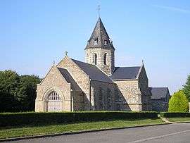 The church in Sainte-Marie-Laumont | |
 Souleuvre-en-Bocage Location within Normandy region  Souleuvre-en-Bocage | |
| Coordinates: 48°56′17″N 0°50′31″W / 48.938°N 0.842°WCoordinates: 48°56′17″N 0°50′31″W / 48.938°N 0.842°W | |
| Country | France |
| Region | Normandy |
| Department | Calvados |
| Arrondissement | Vire |
| Canton | Condé-sur-Noireau |
| Area1 | 187.28 km2 (72.31 sq mi) |
| Population (2013)2 | 8,658 |
| • Density | 46/km2 (120/sq mi) |
| Time zone | UTC+1 (CET) |
| • Summer (DST) | UTC+2 (CEST) |
| INSEE/Postal code | 14061 /14350 |
|
1 French Land Register data, which excludes lakes, ponds, glaciers > 1 km2 (0.386 sq mi or 247 acres) and river estuaries. 2 Population without double counting: residents of multiple communes (e.g., students and military personnel) only counted once. | |
Souleuvre-en-Bocage is a commune in the department of Calvados, northwestern France. The municipality was established on 1 January 2016 by merger of the former communes of Beaulieu, Le Bény-Bocage (the seat), Bures-les-Monts, Campeaux, Carville, Étouvy, La Ferrière-Harang, La Graverie, Malloué, Montamy, Mont-Bertrand, Montchauvet, Le Reculey, Saint-Denis-Maisoncelles, Sainte-Marie-Laumont, Saint-Martin-des-Besaces, Saint-Martin-Don, Saint-Ouen-des-Besaces, Saint-Pierre-Tarentaine and Le Tourneur.[1]
See also
References
| Wikimedia Commons has media related to Souleuvre en Bocage. |
- ↑ Arrêté préfectoral 1 December 2015 (in French)
This article is issued from
Wikipedia.
The text is licensed under Creative Commons - Attribution - Sharealike.
Additional terms may apply for the media files.