Leffard
| Leffard | |
|---|---|
| Commune | |
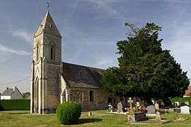 The church in Leffard | |
 Leffard Location within Normandy region  Leffard | |
| Coordinates: 48°55′05″N 0°18′10″W / 48.9181°N 0.3028°WCoordinates: 48°55′05″N 0°18′10″W / 48.9181°N 0.3028°W | |
| Country | France |
| Region | Normandy |
| Department | Calvados |
| Arrondissement | Caen |
| Canton | Falaise |
| Intercommunality | Pays de Falaise |
| Government | |
| • Mayor (2008–2014) | Gérard Faroudja |
| Area1 | 6.89 km2 (2.66 sq mi) |
| Population (2008)2 | 160 |
| • Density | 23/km2 (60/sq mi) |
| Time zone | UTC+1 (CET) |
| • Summer (DST) | UTC+2 (CEST) |
| INSEE/Postal code | 14360 /14700 |
| Elevation |
160–228 m (525–748 ft) (avg. 210 m or 690 ft) |
|
1 French Land Register data, which excludes lakes, ponds, glaciers > 1 km2 (0.386 sq mi or 247 acres) and river estuaries. 2 Population without double counting: residents of multiple communes (e.g., students and military personnel) only counted once. | |
Leffard is a commune in the Calvados department in the Normandy region in northwestern France.
Population
| Historical population | ||
|---|---|---|
| Year | Pop. | ±% |
| 1962 | 154 | — |
| 1968 | 147 | −4.5% |
| 1975 | 156 | +6.1% |
| 1982 | 180 | +15.4% |
| 1990 | 183 | +1.7% |
| 1999 | 168 | −8.2% |
| 2008 | 160 | −4.8% |
See also
References
| Wikimedia Commons has media related to Leffard. |
This article is issued from
Wikipedia.
The text is licensed under Creative Commons - Attribution - Sharealike.
Additional terms may apply for the media files.