Le Torquesne
| Le Torquesne | |
|---|---|
| Commune | |
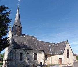 The Notre-Dame church | |
 Le Torquesne Location within Normandy region  Le Torquesne | |
| Coordinates: 49°13′06″N 0°10′07″E / 49.2183°N 0.1686°ECoordinates: 49°13′06″N 0°10′07″E / 49.2183°N 0.1686°E | |
| Country | France |
| Region | Normandy |
| Department | Calvados |
| Arrondissement | Lisieux |
| Canton | Pont-l'Évêque |
| Intercommunality | Blangy Pont-l'Évêque Intercom |
| Government | |
| • Mayor (2008–2014) | Sylvain Marie |
| Area1 | 5.26 km2 (2.03 sq mi) |
| Population (2009)2 | 425 |
| • Density | 81/km2 (210/sq mi) |
| Time zone | UTC+1 (CET) |
| • Summer (DST) | UTC+2 (CEST) |
| INSEE/Postal code | 14694 /14130 |
| Elevation |
93–147 m (305–482 ft) (avg. 140 m or 460 ft) |
|
1 French Land Register data, which excludes lakes, ponds, glaciers > 1 km2 (0.386 sq mi or 247 acres) and river estuaries. 2 Population without double counting: residents of multiple communes (e.g., students and military personnel) only counted once. | |
Le Torquesne is a commune in the Calvados department in the Normandy region in northwestern France.
Population
| Historical population | ||
|---|---|---|
| Year | Pop. | ±% |
| 1962 | 216 | — |
| 1968 | 204 | −5.6% |
| 1975 | 155 | −24.0% |
| 1982 | 205 | +32.3% |
| 1990 | 245 | +19.5% |
| 1999 | 301 | +22.9% |
| 2009 | 425 | +41.2% |
See also
References
External links
![]()
| Authority control |
|---|
This article is issued from
Wikipedia.
The text is licensed under Creative Commons - Attribution - Sharealike.
Additional terms may apply for the media files.