Gonneville-en-Auge
| Gonneville-en-Auge | |
|---|---|
| Commune | |
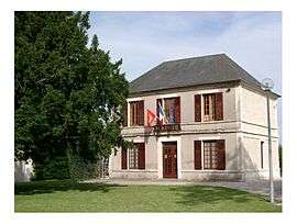 Town hall | |
 Gonneville-en-Auge Location within Normandy region  Gonneville-en-Auge | |
| Coordinates: 49°15′36″N 0°11′25″W / 49.26°N 0.1903°WCoordinates: 49°15′36″N 0°11′25″W / 49.26°N 0.1903°W | |
| Country | France |
| Region | Normandy |
| Department | Calvados |
| Arrondissement | Lisieux |
| Canton | Cabourg |
| Intercommunality | Campagne et Baie de L'Orne |
| Government | |
| • Mayor (2008–2014) | Viviane Follezou |
| Area1 | 4.32 km2 (1.67 sq mi) |
| Population (2008)2 | 409 |
| • Density | 95/km2 (250/sq mi) |
| Time zone | UTC+1 (CET) |
| • Summer (DST) | UTC+2 (CEST) |
| INSEE/Postal code | 14306 /14810 |
| Elevation |
3–30 m (9.8–98.4 ft) (avg. 10 m or 33 ft) |
|
1 French Land Register data, which excludes lakes, ponds, glaciers > 1 km2 (0.386 sq mi or 247 acres) and river estuaries. 2 Population without double counting: residents of multiple communes (e.g., students and military personnel) only counted once. | |
Gonneville-en-Auge is a commune in the Calvados department in the Normandy region in northwestern France.
Population
| Historical population | ||
|---|---|---|
| Year | Pop. | ±% |
| 1793 | 540 | — |
| 1800 | 441 | −18.3% |
| 1806 | 513 | +16.3% |
| 1821 | 546 | +6.4% |
| 1831 | 507 | −7.1% |
| 1841 | 438 | −13.6% |
| 1846 | 440 | +0.5% |
| 1851 | 398 | −9.5% |
| 1856 | 407 | +2.3% |
| 1861 | 406 | −0.2% |
| 1866 | 395 | −2.7% |
| 1872 | 356 | −9.9% |
| 1876 | 343 | −3.7% |
| 1881 | 325 | −5.2% |
| 1886 | 299 | −8.0% |
| 1891 | 303 | +1.3% |
| 1896 | 251 | −17.2% |
| 1901 | 238 | −5.2% |
| 1906 | 253 | +6.3% |
| 1911 | 207 | −18.2% |
| 1921 | 217 | +4.8% |
| 1926 | 217 | +0.0% |
| 1931 | 237 | +9.2% |
| 1936 | 259 | +9.3% |
| 1946 | 155 | −40.2% |
| 1954 | 192 | +23.9% |
| 1962 | 265 | +38.0% |
| 1968 | 239 | −9.8% |
| 1975 | 229 | −4.2% |
| 1982 | 254 | +10.9% |
| 1990 | 310 | +22.0% |
| 1999 | 350 | +12.9% |
| 2008 | 409 | +16.9% |
See also
References
| Wikimedia Commons has media related to Gonneville-en-Auge. |
This article is issued from
Wikipedia.
The text is licensed under Creative Commons - Attribution - Sharealike.
Additional terms may apply for the media files.