Moyaux
| Moyaux | |
|---|---|
| Commune | |
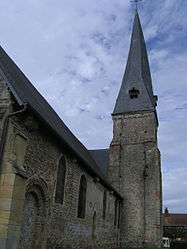 The church in Moyaux | |
 Moyaux Location within Normandy region  Moyaux | |
| Coordinates: 49°11′46″N 0°21′25″E / 49.1961°N 0.3569°ECoordinates: 49°11′46″N 0°21′25″E / 49.1961°N 0.3569°E | |
| Country | France |
| Region | Normandy |
| Department | Calvados |
| Arrondissement | Lisieux |
| Canton | Pont-l'Évêque |
| Intercommunality | CA Lisieux Normandie |
| Government | |
| • Mayor (2008–2014) | Michel Tesson |
| Area1 | 16.23 km2 (6.27 sq mi) |
| Population (2008)2 | 1,342 |
| • Density | 83/km2 (210/sq mi) |
| Time zone | UTC+1 (CET) |
| • Summer (DST) | UTC+2 (CEST) |
| INSEE/Postal code | 14460 /14590 |
| Elevation |
115–171 m (377–561 ft) (avg. 34 m or 112 ft) |
|
1 French Land Register data, which excludes lakes, ponds, glaciers > 1 km2 (0.386 sq mi or 247 acres) and river estuaries. 2 Population without double counting: residents of multiple communes (e.g., students and military personnel) only counted once. | |
Moyaux is a commune in the Calvados department in the Normandy region in northwestern France.
Population
| Historical population | ||
|---|---|---|
| Year | Pop. | ±% |
| 1962 | 658 | — |
| 1968 | 746 | +13.4% |
| 1975 | 857 | +14.9% |
| 1982 | 931 | +8.6% |
| 1990 | 1,185 | +27.3% |
| 1999 | 1,235 | +4.2% |
| 2008 | 1,342 | +8.7% |
See also
References
| Wikimedia Commons has media related to Moyaux. |
This article is issued from
Wikipedia.
The text is licensed under Creative Commons - Attribution - Sharealike.
Additional terms may apply for the media files.