Saint-Martin-aux-Chartrains
| Saint-Martin-aux-Chartrains | |
|---|---|
| Commune | |
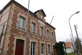 Town hall | |
 Saint-Martin-aux-Chartrains Location within Normandy region  Saint-Martin-aux-Chartrains | |
| Coordinates: 49°18′30″N 0°09′18″E / 49.3083°N 0.155°ECoordinates: 49°18′30″N 0°09′18″E / 49.3083°N 0.155°E | |
| Country | France |
| Region | Normandy |
| Department | Calvados |
| Arrondissement | Lisieux |
| Canton | Pont-l'Évêque |
| Intercommunality | Blangy Pont-l'Évêque |
| Government | |
| • Mayor (2008–2014) | Françoise Delasalle |
| Area1 | 5.06 km2 (1.95 sq mi) |
| Population (2008)2 | 391 |
| • Density | 77/km2 (200/sq mi) |
| Time zone | UTC+1 (CET) |
| • Summer (DST) | UTC+2 (CEST) |
| INSEE/Postal code | 14620 /14130 |
| Elevation |
3–125 m (9.8–410.1 ft) (avg. 13 m or 43 ft) |
|
1 French Land Register data, which excludes lakes, ponds, glaciers > 1 km2 (0.386 sq mi or 247 acres) and river estuaries. 2 Population without double counting: residents of multiple communes (e.g., students and military personnel) only counted once. | |
Saint-Martin-aux-Chartrains is a commune in the Calvados department in the Normandy region in northwestern France.
Population
| Historical population | ||
|---|---|---|
| Year | Pop. | ±% |
| 1962 | 262 | — |
| 1968 | 262 | +0.0% |
| 1975 | 249 | −5.0% |
| 1982 | 309 | +24.1% |
| 1990 | 369 | +19.4% |
| 1999 | 351 | −4.9% |
| 2008 | 391 | +11.4% |
See also
References
| Wikimedia Commons has media related to Saint-Martin-aux-Chartrains. |
This article is issued from
Wikipedia.
The text is licensed under Creative Commons - Attribution - Sharealike.
Additional terms may apply for the media files.