Escoville
| Escoville | ||
|---|---|---|
| Commune | ||
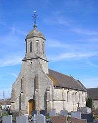 Saint-Laurent | ||
| ||
 Escoville Location within Normandy region  Escoville | ||
| Coordinates: 49°12′40″N 0°14′13″W / 49.2111°N 0.2369°WCoordinates: 49°12′40″N 0°14′13″W / 49.2111°N 0.2369°W | ||
| Country | France | |
| Region | Normandy | |
| Department | Calvados | |
| Arrondissement | Lisieux | |
| Canton | Troarn | |
| Intercommunality | Entre bois et marais | |
| Government | ||
| • Mayor (2008–2014) | Jean-Claude Garnier | |
| Area1 | 5.18 km2 (2.00 sq mi) | |
| Population (2008)2 | 726 | |
| • Density | 140/km2 (360/sq mi) | |
| Time zone | UTC+1 (CET) | |
| • Summer (DST) | UTC+2 (CEST) | |
| INSEE/Postal code | 14246 /14850 | |
| Elevation | 13–42 m (43–138 ft) | |
|
1 French Land Register data, which excludes lakes, ponds, glaciers > 1 km2 (0.386 sq mi or 247 acres) and river estuaries. 2 Population without double counting: residents of multiple communes (e.g., students and military personnel) only counted once. | ||

Escoville is a commune in the Calvados department in the Normandy region in northwestern France.
Population
| Historical population | ||
|---|---|---|
| Year | Pop. | ±% |
| 1962 | 321 | — |
| 1968 | 417 | +29.9% |
| 1975 | 460 | +10.3% |
| 1982 | 438 | −4.8% |
| 1990 | 623 | +42.2% |
| 1999 | 626 | +0.5% |
| 2008 | 726 | +16.0% |
See also
References
A survey of the Scovils or Scovills in England and America : seven hundred years of history and genealogy
External links
| Wikimedia Commons has media related to Escoville. |
This article is issued from
Wikipedia.
The text is licensed under Creative Commons - Attribution - Sharealike.
Additional terms may apply for the media files.