Lasson, Calvados
| Lasson | |
|---|---|
 Saint-Pierre | |
 Lasson Location within Normandy region  Lasson | |
| Coordinates: 49°14′04″N 0°27′45″W / 49.2344°N 0.4625°WCoordinates: 49°14′04″N 0°27′45″W / 49.2344°N 0.4625°W | |
| Country | France |
| Region | Normandy |
| Department | Calvados |
| Arrondissement | Caen |
| Canton | Bretteville-l'Orgueilleuse |
| Intercommunality | Entre Thue et Mue |
| Government | |
| • Mayor (2008–2014) | Michel Bourguignon |
| Area1 | 4.02 km2 (1.55 sq mi) |
| Population (2008)2 | 585 |
| • Density | 150/km2 (380/sq mi) |
| Time zone | UTC+1 (CET) |
| • Summer (DST) | UTC+2 (CEST) |
| INSEE/Postal code | 14356 /14740 |
| Elevation |
34–59 m (112–194 ft) (avg. 30 m or 98 ft) |
|
1 French Land Register data, which excludes lakes, ponds, glaciers > 1 km2 (0.386 sq mi or 247 acres) and river estuaries. 2 Population without double counting: residents of multiple communes (e.g., students and military personnel) only counted once. | |
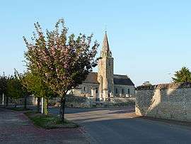
Lasson is a former commune in the Calvados department in the Normandy region in northwestern France. On 1 January 2016, it was merged into the commune of Rots.[1]
Population
| Historical population | ||
|---|---|---|
| Year | Pop. | ±% |
| 1962 | 211 | — |
| 1968 | 228 | +8.1% |
| 1975 | 256 | +12.3% |
| 1982 | 331 | +29.3% |
| 1990 | 382 | +15.4% |
| 1999 | 494 | +29.3% |
| 2008 | 585 | +18.4% |
See also
References
- ↑ Arrêté préfectoral 22 December 2015 (in French)
External links
| Wikimedia Commons has media related to Lasson (Calvados). |
This article is issued from
Wikipedia.
The text is licensed under Creative Commons - Attribution - Sharealike.
Additional terms may apply for the media files.