Cresserons
| Cresserons | |
|---|---|
| Commune | |
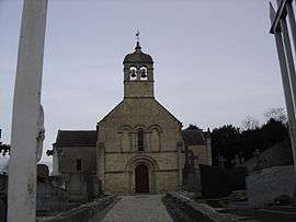 The church in Cresserons | |
 Cresserons Location within Normandy region  Cresserons | |
| Coordinates: 49°17′19″N 0°21′12″W / 49.2886°N 0.3533°WCoordinates: 49°17′19″N 0°21′12″W / 49.2886°N 0.3533°W | |
| Country | France |
| Region | Normandy |
| Department | Calvados |
| Arrondissement | Caen |
| Canton | Courseulles-sur-Mer |
| Intercommunality | Cœur de Nacre |
| Government | |
| • Mayor (2008–2014) | Patrick Lhermine |
| Area1 | 3.59 km2 (1.39 sq mi) |
| Population (2008)2 | 1,231 |
| • Density | 340/km2 (890/sq mi) |
| Time zone | UTC+1 (CET) |
| • Summer (DST) | UTC+2 (CEST) |
| INSEE/Postal code | 14197 /14440 |
| Elevation |
17–59 m (56–194 ft) (avg. 30 m or 98 ft) |
|
1 French Land Register data, which excludes lakes, ponds, glaciers > 1 km2 (0.386 sq mi or 247 acres) and river estuaries. 2 Population without double counting: residents of multiple communes (e.g., students and military personnel) only counted once. | |
Cresserons is a commune in the Calvados department in the Normandy region in northwestern France.
Cresserons is located just south of the beaches of Normandy. During the Battle of Normandy in World War II, British troops arrived there and a battle was fought on 7 June 1944.
Population
| Historical population | ||
|---|---|---|
| Year | Pop. | ±% |
| 1793 | 578 | — |
| 1800 | 428 | −26.0% |
| 1806 | 614 | +43.5% |
| 1821 | 630 | +2.6% |
| 1831 | 641 | +1.7% |
| 1836 | 655 | +2.2% |
| 1841 | 605 | −7.6% |
| 1846 | 617 | +2.0% |
| 1851 | 624 | +1.1% |
| 1856 | 641 | +2.7% |
| 1861 | 628 | −2.0% |
| 1866 | 601 | −4.3% |
| 1872 | 566 | −5.8% |
| 1876 | 531 | −6.2% |
| 1881 | 503 | −5.3% |
| 1886 | 500 | −0.6% |
| 1891 | 482 | −3.6% |
| 1896 | 450 | −6.6% |
| 1901 | 450 | +0.0% |
| 1906 | 470 | +4.4% |
| 1911 | 420 | −10.6% |
| 1921 | 357 | −15.0% |
| 1926 | 347 | −2.8% |
| 1931 | 310 | −10.7% |
| 1936 | 365 | +17.7% |
| 1946 | 373 | +2.2% |
| 1954 | 420 | +12.6% |
| 1962 | 405 | −3.6% |
| 1968 | 393 | −3.0% |
| 1975 | 435 | +10.7% |
| 1982 | 785 | +80.5% |
| 1990 | 953 | +21.4% |
| 1999 | 1,202 | +26.1% |
| 2008 | 1,231 | +2.4% |
| 2008 | 1,231 | +0.0% |
See also
References
| Wikimedia Commons has media related to Cresserons. |
This article is issued from
Wikipedia.
The text is licensed under Creative Commons - Attribution - Sharealike.
Additional terms may apply for the media files.