Le Mesnil-Robert
| Le Mesnil-Robert | ||
|---|---|---|
| Commune | ||
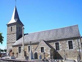 The church in Le Mesnil-Robert | ||
| ||
 Le Mesnil-Robert Location within Normandy region  Le Mesnil-Robert | ||
| Coordinates: 48°52′29″N 0°57′17″W / 48.8747°N 0.9547°WCoordinates: 48°52′29″N 0°57′17″W / 48.8747°N 0.9547°W | ||
| Country | France | |
| Region | Normandy | |
| Department | Calvados | |
| Arrondissement | Vire | |
| Canton | Vire | |
| Intercommunality | Intercom Séverine | |
| Government | ||
| • Mayor (2008–2014) | Jean-Paul Massus | |
| Area1 | 4.08 km2 (1.58 sq mi) | |
| Population (2008)2 | 183 | |
| • Density | 45/km2 (120/sq mi) | |
| Time zone | UTC+1 (CET) | |
| • Summer (DST) | UTC+2 (CEST) | |
| INSEE/Postal code | 14424 /14380 | |
| Elevation |
80–164 m (262–538 ft) (avg. 123 m or 404 ft) | |
|
1 French Land Register data, which excludes lakes, ponds, glaciers > 1 km2 (0.386 sq mi or 247 acres) and river estuaries. 2 Population without double counting: residents of multiple communes (e.g., students and military personnel) only counted once. | ||

Le Mesnil-Robert is a commune in the Calvados department in the Normandy region in northwestern France.
Population
| Historical population | ||
|---|---|---|
| Year | Pop. | ±% |
| 1962 | 171 | — |
| 1968 | 161 | −5.8% |
| 1975 | 151 | −6.2% |
| 1982 | 133 | −11.9% |
| 1990 | 146 | +9.8% |
| 1999 | 158 | +8.2% |
| 2008 | 183 | +15.8% |
See also
References
| Wikimedia Commons has media related to Le Mesnil-Robert. |
This article is issued from
Wikipedia.
The text is licensed under Creative Commons - Attribution - Sharealike.
Additional terms may apply for the media files.