Le Tronquay, Calvados
| Le Tronquay | ||
|---|---|---|
| Commune | ||
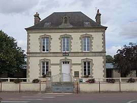 Town hall | ||
| ||
 Le Tronquay Location within Normandy region  Le Tronquay | ||
| Coordinates: 49°13′44″N 0°49′20″W / 49.2289°N 0.8222°WCoordinates: 49°13′44″N 0°49′20″W / 49.2289°N 0.8222°W | ||
| Country | France | |
| Region | Normandy | |
| Department | Calvados | |
| Arrondissement | Bayeux | |
| Canton | Trévières | |
| Intercommunality | CC Isigny-Omaha Intercom | |
| Government | ||
| • Mayor (2008–2014) | Patricia Gady-Duquesnes | |
| Area1 | 13.07 km2 (5.05 sq mi) | |
| Population (2008)2 | 754 | |
| • Density | 58/km2 (150/sq mi) | |
| Time zone | UTC+1 (CET) | |
| • Summer (DST) | UTC+2 (CEST) | |
| INSEE/Postal code | 14714 /14490 | |
| Elevation |
35–106 m (115–348 ft) (avg. 85 m or 279 ft) | |
|
1 French Land Register data, which excludes lakes, ponds, glaciers > 1 km2 (0.386 sq mi or 247 acres) and river estuaries. 2 Population without double counting: residents of multiple communes (e.g., students and military personnel) only counted once. | ||

Le Tronquay is a commune in the Calvados department in the Normandy region in northwestern France.
Population
| Historical population | ||
|---|---|---|
| Year | Pop. | ±% |
| 1962 | 627 | — |
| 1968 | 593 | −5.4% |
| 1975 | 602 | +1.5% |
| 1982 | 623 | +3.5% |
| 1990 | 651 | +4.5% |
| 1999 | 626 | −3.8% |
| 2008 | 754 | +20.4% |
See also
References
| Wikimedia Commons has media related to Le Tronquay (Calvados). |
This article is issued from
Wikipedia.
The text is licensed under Creative Commons - Attribution - Sharealike.
Additional terms may apply for the media files.