Hermival-les-Vaux
| Hermival-les-Vaux | |
|---|---|
| Commune | |
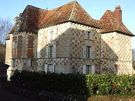 Castle of Hermival-les-Vaux | |
 Hermival-les-Vaux Location within Normandy region  Hermival-les-Vaux | |
| Coordinates: 49°10′14″N 0°17′01″E / 49.1706°N 0.2836°ECoordinates: 49°10′14″N 0°17′01″E / 49.1706°N 0.2836°E | |
| Country | France |
| Region | Normandy |
| Department | Calvados |
| Arrondissement | Lisieux |
| Canton | Pont-l'Évêque |
| Intercommunality | CA Lisieux Normandie |
| Government | |
| • Mayor (2008–2014) | Gérard Elie |
| Area1 | 13.76 km2 (5.31 sq mi) |
| Population (2008)2 | 852 |
| • Density | 62/km2 (160/sq mi) |
| Time zone | UTC+1 (CET) |
| • Summer (DST) | UTC+2 (CEST) |
| INSEE/Postal code | 14326 /14100 |
| Elevation |
52–166 m (171–545 ft) (avg. 150 m or 490 ft) |
|
1 French Land Register data, which excludes lakes, ponds, glaciers > 1 km2 (0.386 sq mi or 247 acres) and river estuaries. 2 Population without double counting: residents of multiple communes (e.g., students and military personnel) only counted once. | |
Hermival-les-Vaux is a commune in the Calvados department in the Normandy region in northwestern France.
Population
| Historical population | ||
|---|---|---|
| Year | Pop. | ±% |
| 1793 | 725 | — |
| 1800 | 753 | +3.9% |
| 1806 | 784 | +4.1% |
| 1821 | 694 | −11.5% |
| 1831 | 724 | +4.3% |
| 1836 | 735 | +1.5% |
| 1841 | 675 | −8.2% |
| 1846 | 671 | −0.6% |
| 1851 | 658 | −1.9% |
| 1856 | 641 | −2.6% |
| 1861 | 637 | −0.6% |
| 1866 | 587 | −7.8% |
| 1872 | 544 | −7.3% |
| 1876 | 531 | −2.4% |
| 1881 | 501 | −5.6% |
| 1886 | 532 | +6.2% |
| 1891 | 527 | −0.9% |
| 1896 | 487 | −7.6% |
| 1901 | 476 | −2.3% |
| 1906 | 460 | −3.4% |
| 1911 | 433 | −5.9% |
| 1921 | 415 | −4.2% |
| 1926 | 412 | −0.7% |
| 1931 | 424 | +2.9% |
| 1936 | 377 | −11.1% |
| 1946 | 377 | +0.0% |
| 1954 | 384 | +1.9% |
| 1962 | 412 | +7.3% |
| 1968 | 395 | −4.1% |
| 1975 | 526 | +33.2% |
| 1982 | 518 | −1.5% |
| 1990 | 673 | +29.9% |
| 1999 | 760 | +12.9% |
| 2008 | 852 | +12.1% |
See also
References
| Wikimedia Commons has media related to Hermival-les-Vaux. |
This article is issued from
Wikipedia.
The text is licensed under Creative Commons - Attribution - Sharealike.
Additional terms may apply for the media files.