Éterville
| Éterville | |
|---|---|
| Commune | |
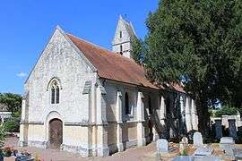 St. John the Baptist church | |
 Éterville Location within Normandy region  Éterville | |
| Coordinates: 49°08′41″N 0°25′27″W / 49.1447°N 0.4242°WCoordinates: 49°08′41″N 0°25′27″W / 49.1447°N 0.4242°W | |
| Country | France |
| Region | Normandy |
| Department | Calvados |
| Arrondissement | Caen |
| Canton | Caen-5 |
| Intercommunality | CU Caen la Mer |
| Government | |
| • Mayor (2008–2014) | Paul Ragot |
| Area1 | 4.87 km2 (1.88 sq mi) |
| Population (2008)2 | 1,360 |
| • Density | 280/km2 (720/sq mi) |
| Time zone | UTC+1 (CET) |
| • Summer (DST) | UTC+2 (CEST) |
| INSEE/Postal code | 14254 /14930 |
| Elevation |
12–78 m (39–256 ft) (avg. 24 m or 79 ft) |
|
1 French Land Register data, which excludes lakes, ponds, glaciers > 1 km2 (0.386 sq mi or 247 acres) and river estuaries. 2 Population without double counting: residents of multiple communes (e.g., students and military personnel) only counted once. | |
Éterville is a commune in the Calvados department in the Normandy region in northwestern France.
Population
| Historical population | ||
|---|---|---|
| Year | Pop. | ±% |
| 1962 | 307 | — |
| 1968 | 319 | +3.9% |
| 1975 | 378 | +18.5% |
| 1982 | 493 | +30.4% |
| 1990 | 766 | +55.4% |
| 1999 | 1,043 | +36.2% |
| 2008 | 1,360 | +30.4% |
See also
References
| Wikimedia Commons has media related to Éterville. |
This article is issued from
Wikipedia.
The text is licensed under Creative Commons - Attribution - Sharealike.
Additional terms may apply for the media files.