Brucourt
| Brucourt | ||
|---|---|---|
| Commune | ||
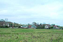 A general view of Brucourt | ||
| ||
 Brucourt Location within Normandy region  Brucourt | ||
| Coordinates: 49°14′47″N 0°05′57″W / 49.2464°N 0.0992°WCoordinates: 49°14′47″N 0°05′57″W / 49.2464°N 0.0992°W | ||
| Country | France | |
| Region | Normandy | |
| Department | Calvados | |
| Arrondissement | Lisieux | |
| Canton | Cabourg | |
| Intercommunality | Pays d'Auge dozuléen | |
| Government | ||
| • Mayor (2008–2014) | Régine David | |
| Area1 | 6.6 km2 (2.5 sq mi) | |
| Population (2008)2 | 138 | |
| • Density | 21/km2 (54/sq mi) | |
| Time zone | UTC+1 (CET) | |
| • Summer (DST) | UTC+2 (CEST) | |
| INSEE/Postal code | 14110 /14160 | |
| Elevation |
2–105 m (6.6–344.5 ft) (avg. 4 m or 13 ft) | |
|
1 French Land Register data, which excludes lakes, ponds, glaciers > 1 km2 (0.386 sq mi or 247 acres) and river estuaries. 2 Population without double counting: residents of multiple communes (e.g., students and military personnel) only counted once. | ||

Brucourt is a commune in the Calvados department in the Normandy region in northwestern France.
Population
| Historical population | ||
|---|---|---|
| Year | Pop. | ±% |
| 1793 | 233 | — |
| 1800 | 204 | −12.4% |
| 1806 | 190 | −6.9% |
| 1821 | 167 | −12.1% |
| 1831 | 156 | −6.6% |
| 1836 | 151 | −3.2% |
| 1841 | 158 | +4.6% |
| 1846 | 141 | −10.8% |
| 1851 | 134 | −5.0% |
| 1856 | 145 | +8.2% |
| 1861 | 121 | −16.6% |
| 1866 | 130 | +7.4% |
| 1872 | 134 | +3.1% |
| 1876 | 122 | −9.0% |
| 1886 | 140 | +14.8% |
| 1891 | 154 | +10.0% |
| 1896 | 131 | −14.9% |
| 1901 | 130 | −0.8% |
| 1906 | 154 | +18.5% |
| 1911 | 146 | −5.2% |
| 1921 | 141 | −3.4% |
| 1926 | 120 | −14.9% |
| 1931 | 123 | +2.5% |
| 1936 | 117 | −4.9% |
| 1946 | 108 | −7.7% |
| 1954 | 129 | +19.4% |
| 1962 | 111 | −14.0% |
| 1968 | 114 | +2.7% |
| 1975 | 84 | −26.3% |
| 1982 | 107 | +27.4% |
| 1990 | 108 | +0.9% |
| 1999 | 120 | +11.1% |
| 2008 | 138 | +15.0% |
See also
References
| Wikimedia Commons has media related to Brucourt. |
This article is issued from
Wikipedia.
The text is licensed under Creative Commons - Attribution - Sharealike.
Additional terms may apply for the media files.