Vignats
| Vignats | |
|---|---|
| Commune | |
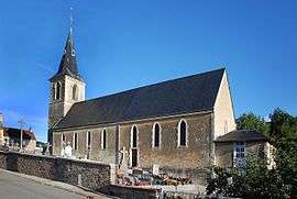 The church in Vignats | |
 Vignats Location within Normandy region  Vignats | |
| Coordinates: 48°51′19″N 0°06′09″W / 48.8553°N 0.1025°WCoordinates: 48°51′19″N 0°06′09″W / 48.8553°N 0.1025°W | |
| Country | France |
| Region | Normandy |
| Department | Calvados |
| Arrondissement | Caen |
| Canton | Falaise |
| Intercommunality | Pays de Falaise |
| Government | |
| • Mayor (2008–2014) | Érick Dewaële |
| Area1 | 8.80 km2 (3.40 sq mi) |
| Population (2008)2 | 256 |
| • Density | 29/km2 (75/sq mi) |
| Time zone | UTC+1 (CET) |
| • Summer (DST) | UTC+2 (CEST) |
| INSEE/Postal code | 14751 /14700 |
| Elevation |
86–175 m (282–574 ft) (avg. 129 m or 423 ft) |
|
1 French Land Register data, which excludes lakes, ponds, glaciers > 1 km2 (0.386 sq mi or 247 acres) and river estuaries. 2 Population without double counting: residents of multiple communes (e.g., students and military personnel) only counted once. | |
Vignats is a commune in the Calvados department in the Normandy region in northwestern France.
Population
| Historical population | ||
|---|---|---|
| Year | Pop. | ±% |
| 1962 | 295 | — |
| 1968 | 299 | +1.4% |
| 1975 | 266 | −11.0% |
| 1982 | 249 | −6.4% |
| 1990 | 206 | −17.3% |
| 1999 | 224 | +8.7% |
| 2008 | 256 | +14.3% |
See also
References
| Wikimedia Commons has media related to Vignats. |
This article is issued from
Wikipedia.
The text is licensed under Creative Commons - Attribution - Sharealike.
Additional terms may apply for the media files.