Damblainville
| Damblainville | |
|---|---|
| Commune | |
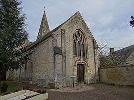 The church in Damblainville | |
 Damblainville Location within Normandy region  Damblainville | |
| Coordinates: 48°54′59″N 0°06′41″W / 48.9164°N 0.1114°WCoordinates: 48°54′59″N 0°06′41″W / 48.9164°N 0.1114°W | |
| Country | France |
| Region | Normandy |
| Department | Calvados |
| Arrondissement | Caen |
| Canton | Falaise |
| Intercommunality | Pays de Falaise |
| Government | |
| • Mayor (2014–2020) | Michel Caillouet |
| Area1 | 6.35 km2 (2.45 sq mi) |
| Population (2014)2 | 230 |
| • Density | 36/km2 (94/sq mi) |
| Time zone | UTC+1 (CET) |
| • Summer (DST) | UTC+2 (CEST) |
| INSEE/Postal code | 14216 /14620 |
| Elevation |
54–157 m (177–515 ft) (avg. 80 m or 260 ft) |
|
1 French Land Register data, which excludes lakes, ponds, glaciers > 1 km2 (0.386 sq mi or 247 acres) and river estuaries. 2 Population without double counting: residents of multiple communes (e.g., students and military personnel) only counted once. | |
Damblainville is a commune in the Calvados department and Normandy region of north-western France.
Its inhabitants are known as Damblainvillais.
Population
| Historical population | ||
|---|---|---|
| Year | Pop. | ±% |
| 1946 | 231 | — |
| 1954 | 188 | −18.6% |
| 1962 | 165 | −12.2% |
| 1968 | 171 | +3.6% |
| 1975 | 230 | +34.5% |
| 1982 | 220 | −4.3% |
| 1990 | 193 | −12.3% |
| 1999 | 189 | −2.1% |
| 2007 | 211 | +11.6% |
| 2014 | 230 | +9.0% |
See also
References
| Wikimedia Commons has media related to Damblainville. |
This article is issued from
Wikipedia.
The text is licensed under Creative Commons - Attribution - Sharealike.
Additional terms may apply for the media files.