Ernes
| Ernes | |
|---|---|
| Commune | |
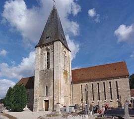 The church in Ernes | |
 Ernes Location within Normandy region  Ernes | |
| Coordinates: 49°01′03″N 0°07′20″W / 49.0175°N 0.1222°WCoordinates: 49°01′03″N 0°07′20″W / 49.0175°N 0.1222°W | |
| Country | France |
| Region | Normandy |
| Department | Calvados |
| Arrondissement | Caen |
| Canton | Falaise |
| Intercommunality | Pays de Falaise |
| Government | |
| • Mayor (2008–2014) | Yves Lucas |
| Area1 | 8.90 km2 (3.44 sq mi) |
| Population (2008)2 | 298 |
| • Density | 33/km2 (87/sq mi) |
| Time zone | UTC+1 (CET) |
| • Summer (DST) | UTC+2 (CEST) |
| INSEE/Postal code | 14245 /14270 |
| Elevation |
35–84 m (115–276 ft) (avg. 50 m or 160 ft) |
|
1 French Land Register data, which excludes lakes, ponds, glaciers > 1 km2 (0.386 sq mi or 247 acres) and river estuaries. 2 Population without double counting: residents of multiple communes (e.g., students and military personnel) only counted once. | |
Ernes is a commune in the Calvados department in the Normandy region in northwestern France.
Population
| Historical population | ||
|---|---|---|
| Year | Pop. | ±% |
| 1962 | 394 | — |
| 1968 | 395 | +0.3% |
| 1975 | 322 | −18.5% |
| 1982 | 311 | −3.4% |
| 1990 | 266 | −14.5% |
| 1999 | 285 | +7.1% |
| 2008 | 298 | +4.6% |
See also
References
| Wikimedia Commons has media related to Ernes. |
This article is issued from
Wikipedia.
The text is licensed under Creative Commons - Attribution - Sharealike.
Additional terms may apply for the media files.