Canteloup, Calvados
| Canteloup | |
|---|---|
| Commune | |
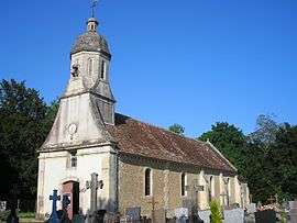 The church in Canteloup | |
 Canteloup Location within Normandy region  Canteloup | |
| Coordinates: 49°08′00″N 0°07′46″W / 49.1333°N 0.1294°WCoordinates: 49°08′00″N 0°07′46″W / 49.1333°N 0.1294°W | |
| Country | France |
| Region | Normandy |
| Department | Calvados |
| Arrondissement | Caen |
| Canton | Troarn |
| Intercommunality | Val ès dunes |
| Government | |
| • Mayor (2008–2014) | Sophie de Gibon |
| Area1 | 2.32 km2 (0.90 sq mi) |
| Population (2008)2 | 178 |
| • Density | 77/km2 (200/sq mi) |
| Time zone | UTC+1 (CET) |
| • Summer (DST) | UTC+2 (CEST) |
| INSEE/Postal code | 14134 /14370 |
| Elevation |
24–44 m (79–144 ft) (avg. 38 m or 125 ft) |
|
1 French Land Register data, which excludes lakes, ponds, glaciers > 1 km2 (0.386 sq mi or 247 acres) and river estuaries. 2 Population without double counting: residents of multiple communes (e.g., students and military personnel) only counted once. | |
Canteloup is a commune in the Calvados department in the Normandy region in northwestern France.
Population
| Historical population | ||
|---|---|---|
| Year | Pop. | ±% |
| 1962 | 113 | — |
| 1968 | 103 | −8.8% |
| 1975 | 126 | +22.3% |
| 1982 | 181 | +43.7% |
| 1990 | 180 | −0.6% |
| 1999 | 166 | −7.8% |
| 2008 | 178 | +7.2% |
See also
References
| Wikimedia Commons has media related to Canteloup (Calvados). |
This article is issued from
Wikipedia.
The text is licensed under Creative Commons - Attribution - Sharealike.
Additional terms may apply for the media files.