Carville, Calvados
| Carville | |
|---|---|
 | |
 Carville Location within Normandy region  Carville | |
| Coordinates: 48°55′50″N 0°51′28″W / 48.9306°N 0.8578°WCoordinates: 48°55′50″N 0°51′28″W / 48.9306°N 0.8578°W | |
| Country | France |
| Region | Normandy |
| Department | Calvados |
| Arrondissement | Vire |
| Canton | Condé-sur-Noireau |
| Government | |
| • Mayor (2008–2014) | Rober Tiberti |
| Area1 | 10.43 km2 (4.03 sq mi) |
| Population (2008)2 | 348 |
| • Density | 33/km2 (86/sq mi) |
| Time zone | UTC+1 (CET) |
| • Summer (DST) | UTC+2 (CEST) |
| INSEE/Postal code | 14139 /14350 |
| Elevation |
73–206 m (240–676 ft) (avg. 153 m or 502 ft) |
|
1 French Land Register data, which excludes lakes, ponds, glaciers > 1 km2 (0.386 sq mi or 247 acres) and river estuaries. 2 Population without double counting: residents of multiple communes (e.g., students and military personnel) only counted once. | |
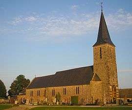
Carville is a former commune in the Calvados department in the Normandy region in northwestern France. On 1 January 2016, it was merged into the new commune of Souleuvre-en-Bocage.[1]
Population
| Historical population | ||
|---|---|---|
| Year | Pop. | ±% |
| 1962 | 407 | — |
| 1968 | 394 | −3.2% |
| 1975 | 360 | −8.6% |
| 1982 | 324 | −10.0% |
| 1990 | 312 | −3.7% |
| 1999 | 302 | −3.2% |
| 2008 | 348 | +15.2% |
See also
References
- ↑ Arrêté préfectoral 1 December 2015 (in French)
| Wikimedia Commons has media related to Carville (Calvados). |
This article is issued from
Wikipedia.
The text is licensed under Creative Commons - Attribution - Sharealike.
Additional terms may apply for the media files.