Fresney-le-Puceux
| Fresney-le-Puceux | |
|---|---|
| Commune | |
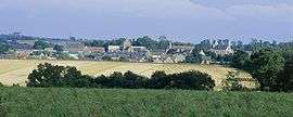 A general view of Fresney-le-Puceux | |
 Fresney-le-Puceux Location within Normandy region  Fresney-le-Puceux | |
| Coordinates: 49°03′49″N 0°22′13″W / 49.0636°N 0.3703°WCoordinates: 49°03′49″N 0°22′13″W / 49.0636°N 0.3703°W | |
| Country | France |
| Region | Normandy |
| Department | Calvados |
| Arrondissement | Caen |
| Canton | Thury-Harcourt |
| Intercommunality | Le Cingal |
| Government | |
| • Mayor (2008–2014) | Didier Alphonse |
| Area1 | 9.65 km2 (3.73 sq mi) |
| Population (2008)2 | 647 |
| • Density | 67/km2 (170/sq mi) |
| Time zone | UTC+1 (CET) |
| • Summer (DST) | UTC+2 (CEST) |
| INSEE/Postal code | 14290 /14680 |
| Elevation |
20–108 m (66–354 ft) (avg. 60 m or 200 ft) |
|
1 French Land Register data, which excludes lakes, ponds, glaciers > 1 km2 (0.386 sq mi or 247 acres) and river estuaries. 2 Population without double counting: residents of multiple communes (e.g., students and military personnel) only counted once. | |
Fresney-le Puceux is a commune in the Calvados department in the Normandy region in northwestern France.
Population
| Historical population | ||
|---|---|---|
| Year | Pop. | ±% |
| 1962 | 513 | — |
| 1968 | 524 | +2.1% |
| 1975 | 534 | +1.9% |
| 1982 | 587 | +9.9% |
| 1990 | 615 | +4.8% |
| 1999 | 657 | +6.8% |
| 2008 | 647 | −1.5% |
See also
References
| Wikimedia Commons has media related to Fresney-le-Puceux. |
This article is issued from
Wikipedia.
The text is licensed under Creative Commons - Attribution - Sharealike.
Additional terms may apply for the media files.